


By James Stoness
Why are we driving all the way from Ontario to visit British Columbia’s Chilcotin Plateau for the third time in less than a dozen years? The answer is hidden somewhere in the magnificent scenery, and that unexplained feeling you have when you arrive at somewhere special. The attraction is in seeing a sparsely populated countryside, with cattle grazing land that rises to the feet of snowclad peaks. Did I forget to mention the intensely blue lakes nestled among evergreen forests?
My first knowledge of this region came from reading a great book, ‘Three Against the Wilderness’, by Eric Collier. It’s an early 1900’s story of a man raising a family in the British Columbia wilderness, many kilometres from easy contact with civilization. It was his dream to bring back the beaver to restore the dying, and burning landscape to its former state. It’s a good book and made me want to see that part of Canada. In 1994 the Canadian Army Engineers restored Collier’s old homestead. A rough dirt road leads from BC-20, forty kilometres to the site.
Highway BC-20 starts at the small city of Williams Lake, the centre of cowboy country. If you arrive in July, on the long weekend, the Williams Lake Stampede hosts several rodeo events complete with the risky manoeuvres by clowns as they try to detract a definitely fierce and angry bull from taking out his revenge on the cowboy that was on his back and is now on the ground. You will likely enjoy the exciting chuck wagon races as those many horse teams vie, wheel hub to wheel hub, for the final stretch of the raceway. Since Williams Lake is a supply centre for ranches and for the logging industry it’s a good place for you to fuel up, and stock up the kitchen.
It’s 460 km to Bella Coola at the Pacific end of BC-20 and along with the beauty of the countryside you need to be aware that you are crossing plateau and canyon country and there will be some quite steep hills. Your reward to driving it will be the rafting possibilities of some of the dashing rivers, or perhaps kayaking, and of course the lakes will offer outstanding fishing and there are many outfitters ready to help.
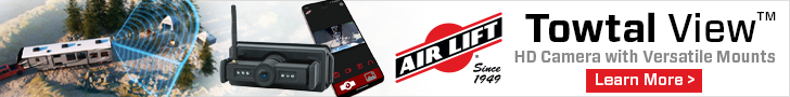
You’ve barely climbed out of Williams Lake when you start a long descent through spectacular volcanic cliffs to reach the Fraser River at Sheep Creek Bridge. The switchback road that follows is steep and long before ending atop the plateau. Fences along the road, built in the old style of rustic snake rail fences, front some of the several small ranches scattered over the verdant plateau. Snowy topped mountains backdrop small lakes and streams. Ancient volcanic ash, scattered from nearby extinct volcanoes has eroded creating the weirdly shaped hoodoos. This is good animal habitat and deer and moose are frequent visitors, and the bighorn sheep look down upon your passage from aerie lofts on the high cliffs.
The Chilcotin Plateau is ideal for exploring off the main highway. There are many kilometres of side roads leading to ranches, lakes or logging sites. If you have a vehicle separate from your RV, this country is made for you.
The Historic Chilcotin Lodge has a few campsites nearby. By leaving your RV there as a camp, you can drive to Farwell Canyon on a good gravel road. At the canyon there are long switchbacks down to the bridge across Chilcotin River and up again. As we drove along the side of the cliff I was surprised to see across the gorge Canada’s largest moving sand dune. This is a remarkable dune that seems to change colours as the daylight changes and its ripple pattern changes with the wind.
If you followed the gravel road southeast it would be possible to reach the location of the old Gang Ranch, largest ranch in North America at one time, and then continue to the highway to Williams Lake and return to your RV. Instead, turn west and north to follow the road back out to BC-20 and just explore before returning to the RV.
If you can make arrangements to park your RV at Hanceville on the dirt strip near the store and by the highway, you can take a great trip south in a car or truck into the Nemiah Valley. It’s mostly a good road with some roughness and lots of cattle guards. There are many steep winding turns and plenty of climbing and descending as the road cuts through the forest and the valleys. Higher elevations present you with magnificent views of huge snow covered peaks in front of you.
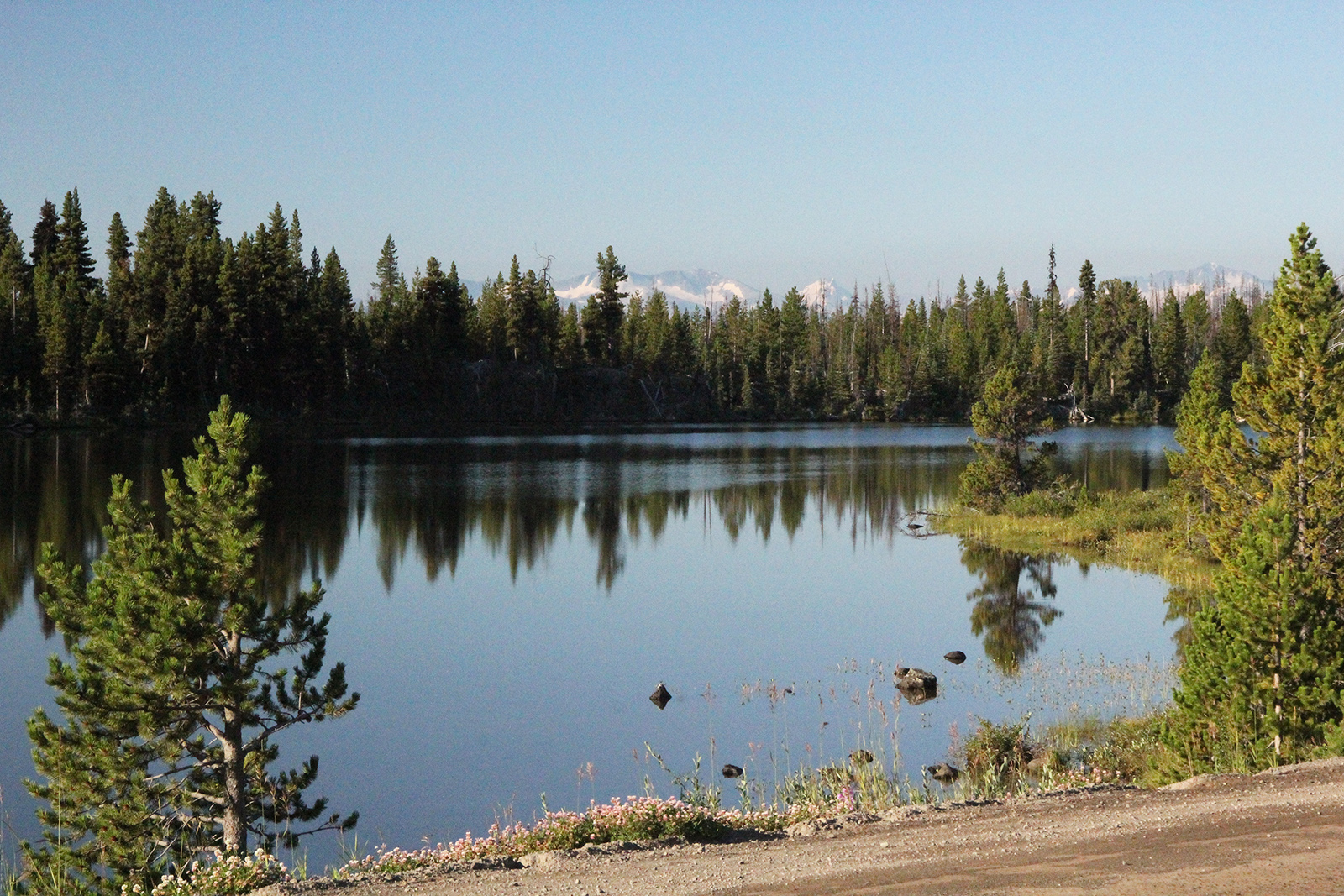
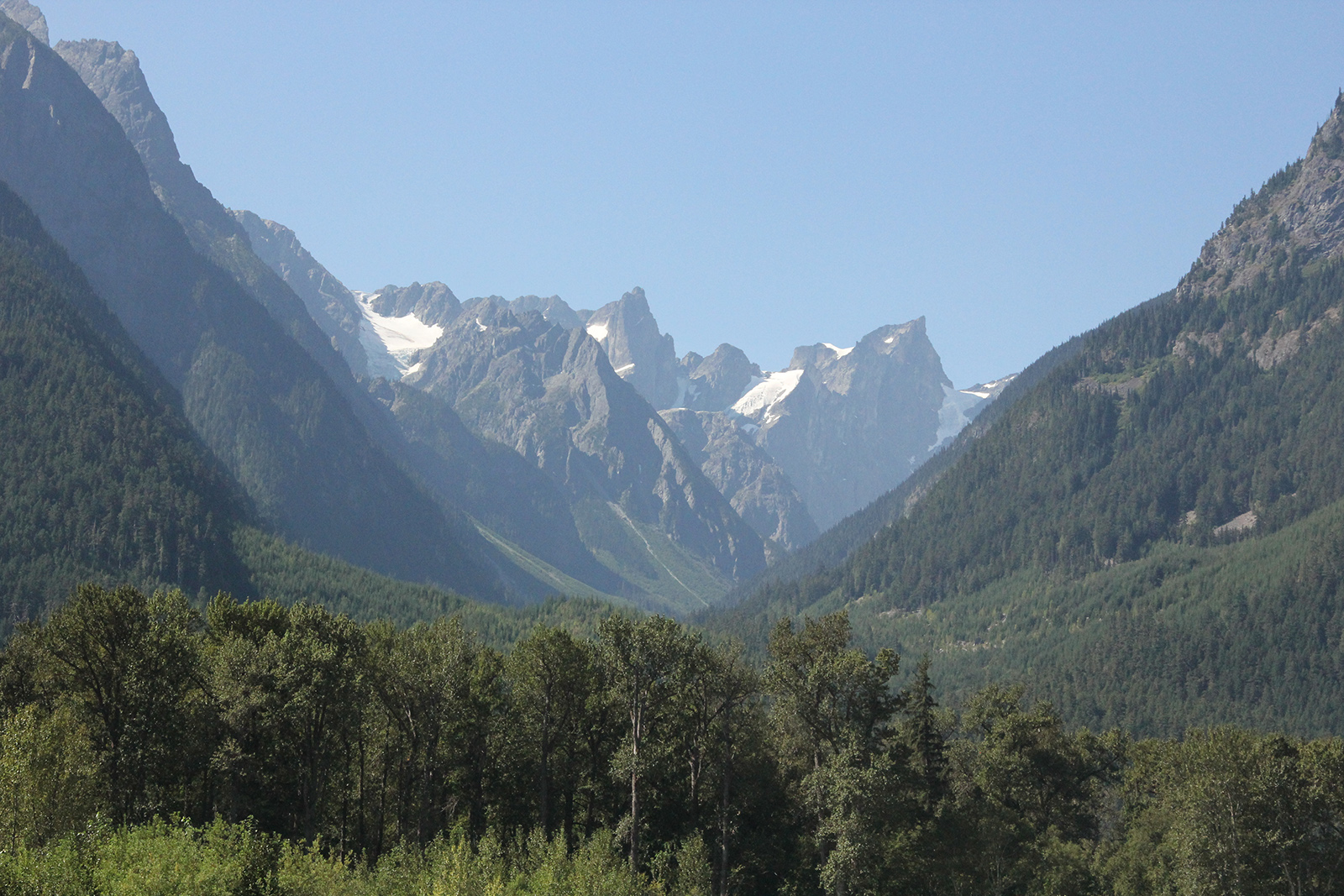
The road passes a few active logging areas before it slips across the bridge over the wide Taseko River which will be white with glacial milk, with rapids and whitecaps. Near an old church there are a few campsites, and an RV parked in one of them indicated that the road is suitable for RVs if done slowly and carefully. These campsites have a great view across a long lake, backdropped by huge mountains. If one drives further along a rougher road you can perhaps reach the edge of Chilko Lake, one of British Columbia’s premier lakes. This is a long narrow lake between high mountain cliffs and is reputed to be dangerous for boats and canoes because the winds can quickly produce high waves and the steep cliffs make it difficult to reach the shore safely.
Tsilos Provincial Park, operated jointly with the natives of the Nemiah Valley, protects forever the lands around Chilko Lake which have been protected for centuries by the natives.
On our way to the community of Tatla Lake, to our pleasant surprise, some residents of the community told us to climb 3 km on a gravel road to a place overlooking Martin Lake and offering long views down across open meadows. It was an easy drive, and from our campsite we saw herds of wild horses grazing far down in the quiet fields. Beyond those meadows was the highest mountain in the province and its many glaciers showed up easily from our campsite.
We left our motorhome and drove the Jeep south on a gravel road looking for Chilko Lake. We passed the occasional mountain farm, some using irrigation to help the crops in dry times. Occasional glimpses of white peaked mountains are just a peek into the views to come. We passed a large blue lake and came to a choice of roads at a wye. Signage is not a priority on these back roads. We stayed to the right and ended up at a provincial park with a rutted road that would swallow an army truck. We backed into a very sharp turn-off that dropped down to the water of Chilko Lake.
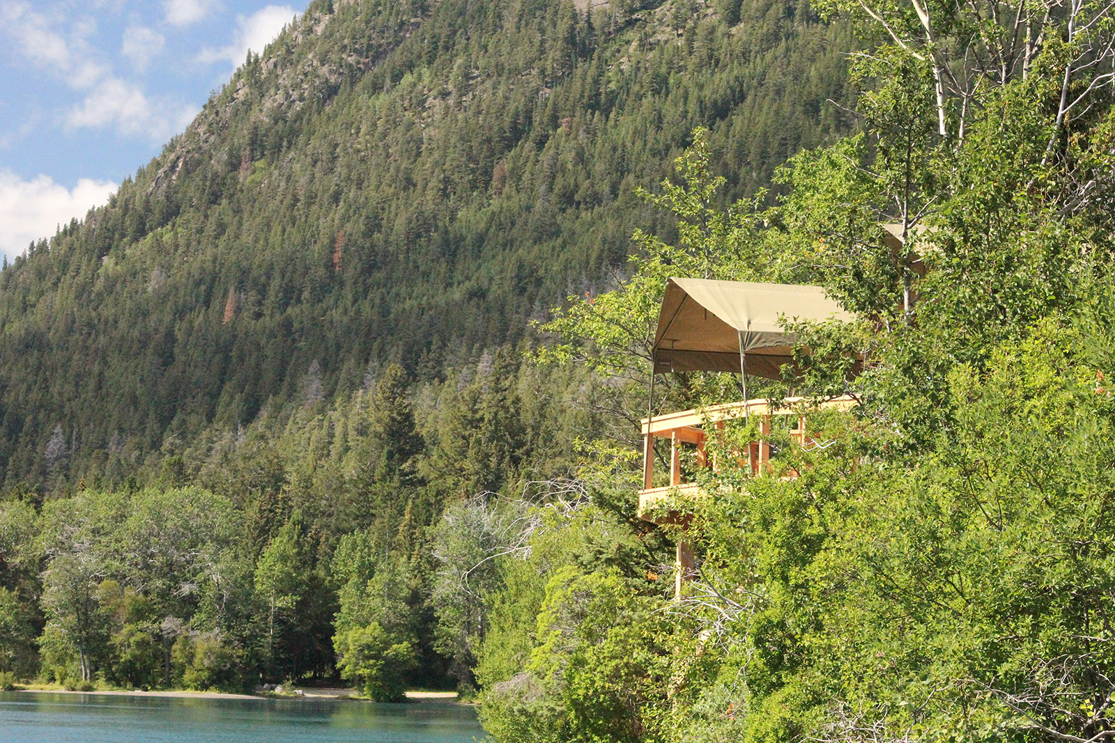
It turned out to be our lucky day because we had arrived at a just being built ‘bear resort’. It was patterned after African safari viewing stands. We were invited to sandwiches and a drink and were shown around the wooden structure. It’s perched high above the grizzly bears giving the customers very good views. They were in the process of creating little rooms to stay overnight out of wood to replace a large white safari tent, which they tried. It was shredded and blown away in a storm, bending the support rails. From their balcony they had a great view along Chilko Lake.
We met a man there who insisted we visit the Huston Lodge. This is a magnificent log structure, interesting inside for its use of natural raw wood from the forest to create bed posts, stair rails, and chairs. In the bathroom there was a massive sink carved from a solid block of lava rock. We were offered a cold drink in thick-walled, heavy goblets, right out of the freezer, and sat in the huge lounge with a fantastic view across the lake to the snowy mountains. Reluctantly, we soon returned to the Jeep for a long drive on gravel roads back to the motorhome, and the day was getting short. With a maze of unlabelled roads, this would not be a good place after dark.
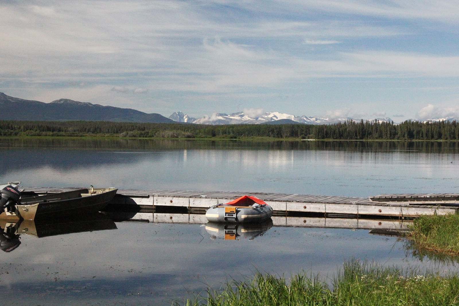
The next day, moving on west, we stopped to camp at the Dean on the Nimpo Lodge. This is a beautiful building and a lot of fishermen have flown in here over the years to some topnotch fishing. As with many of the lodges on the Chilcotin, their clients have grown older, some unable to go anymore, and the younger generation don’t have their interests. It’s making survival difficult for many of these lodges.
Up the road, our next stop was at Anahim Lake where we camped at Escott Bay Lodge operated by Bill and Darlene. Our view across the lake to the white mountains was just perfect. If we had had an extra few days Bill would have taken us on an overnight backcountry horse trip, or arranged a flight over the coloured mountains of Tweedsmuir Provincial Park. That would have been terrific!
We left the motorhome there and headed to Bella Coola, on the Pacific Coast. The road was gravel for 36 miles, from Anahim Lake to the bottom of The Big Hill. In two hours we met 4 vehicles. The road up the Big Hill is the Freedom Road. When the government told the locals in the valley it was not possible to build a road over the mountain to give them access to the rest of Canada, they pooled their money and machinery, and did it, and gained their freedom. It may have been crooked, and narrow, with up to 18% grades, but they had a road. It’s used by cars, transports, buses and RVs. But it’s not for the timid. Its steep sides with no guard rails, and long drops scare some people. Others do not know how to go down in their low gears and avoid long periods of braking.
Near the bottom you cross the Alexander Mackenzie hiking trail, which follows the route taken by him when he became the first man across North America by foot and canoe.
The highway travels down a glaciated U-shaped valley to Bella Coola. This is rain forest country and you will see some magnificently large cedar trees.
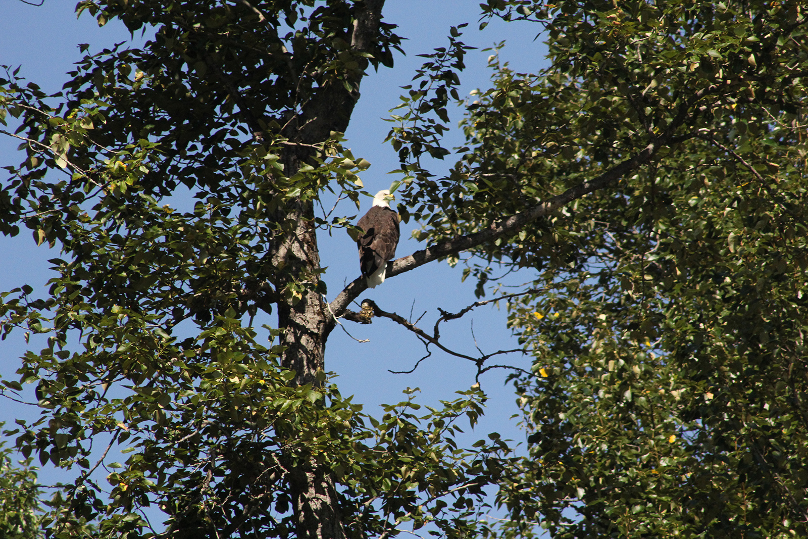
Soon we returned to the foot of the Big Hill to spend a night at the Tweedsmuir Park Lodge. Our cabin looked across the river to the grey mountains with their white glaciers. Although in the winter it is a heli-skiing centre, in the late summer it’s a grizzly bear capital. People come from everywhere to see them. While there we did a river boat float trip hoping to see some. The views of the mountains from the river are great, and we saw many eagles, but no bears. Sylvia saw a few salmon which means the run had just begun. Ken, the boat guide, said from now on the numbers of salmon would rise dramatically. The eagles know that, and that’s why they are arriving. So we were about a week early for the bears. But the float trip was great, and the pictures too. A few years ago we hiked with Doug on the Trail and saw 14 grizzly bears eating and catching salmon along the river. Doug is still there, and still taking people out to see that huge bear catching fish. The lodge has now built a high grizzly bear viewing stand down by the river.
Recently the government cancelled the large ferry that could easily shuttle RVs between Vancouver and Bella Coola, thus severing one of British Columbia’s circle drives. Now visitors from Williams Lake must drive the 460 km both ways. This will make it hard on the economy of the campgrounds and lodges.
If there is anything good about it, it’s the fact that the scenery seems totally different when seen coming back in the opposite direction. If you are looking for a trip that’s a little different, take a look at the map, and give this one a try. We’ve enjoyed it tremendously and met some great people.

