


A visit to this British Columbia hide-a-way will place you in region where time virtually stands still.
By James Stoness
It’s a typical picture of prospecting for gold in a stream – men stooped over, busily rinsing the sand and sediment out of a gold pan. Eagerly they peer into the residue at the bottom of the pan, hoping beyond hope to see a few flecks of gold, or maybe a dull nugget.
The cold, splashing stream they are wading in is possibly backdropped by a glacier clad mountain peak, and edged by a thick forest that has cast deadfalls into the stream. It is wonderful scenery but they are too tired to look at it. If we go back many years, this is the likely scenario for the gold discoveries in British Columbia’s Bridge River Valley, located approximately 300 km north of Vancouver, and approximately 100 km west of Lillooet.
In the 1850s, some prospectors picked a few nuggets out of the Bridge River that initiated a gold rush. By the end of the century, a shaft went down into the hard rock of the mountain establishing the Bralorne Mine and the community of Bralorne began to grow. Yet, it was not until the 1930s that the rush took off, and Bralorne grew into a progressive community with a population of 3,000 with schools, churches, and stores. These miners dug into the mountain creating almost 160 kilometres of little darkened tunnels, lined with logs from the adjacent mountain. Their results produced millions of dollars in gold making it the richest gold mine in Canada.
Then came the low prices of gold in 1971, and it was over. The people left everything behind and headed for civilization, except for a few hopefuls who stayed on in the belief the mine would recover. Gold is still there, and there is active exploration of the deposits. The community collapsed leaving only shadows, but a playground remains for those who like to explore. You can hike on the old trails left by the prospectors searching for other gold deposits, or even take your four-wheel drive Jeep over rough paths to see what is at the end.
Something that didn’t vanish is the great, majestic mountain scenery of the area. The mountains are rough, carved by water and ice into steep walled canyons where the sound of turbulent waters echo from the cliffs. Therein lies their beauty.
Visualize summer when the mountain meadows are a mass of blooming flowers, with startling hues of purples, and contrasting yellows and whites. In the background, the green cloaked-mountain flows upward to the red coloured peaks, terminating in the white caps of a snowfield. Did I mention that all of this is framed by a deep blue sky punctuated by billowing white clouds? This is truly a great place.
It’s worth a visit just to drive and wander among the ghosts of those who lived and worked there. The Bralorne Pioneer Museum holds a collection of historical exhibits. Outside you will find neatly painted pieces of equipment from the mines.
The easy way into the Bridge River valley is to camp at the campground in Lillooet, take a car or truck and follow the Fraser River out of town. There’s a 13 percent hill down just north of town, but it’s paved. At the bridge over the Bridge River, turn west. The road alternates between gravel and pavement. The scenery is terrific and everywhere the mountains squeeze in on the valley. There are exposed places on the cliffs that show hundreds of feet of alluvial deposits. When these deposits are disturbed – such as when digging the road – they tend to slide. There are lots of slides and some slide areas deposit stones and gravel on the road.
During our trip there were a few exciting places that had sheer cliffs climbing above us, alternating with steep gravel slopes. Meanwhile, we were driving a few hundred feet above the splashing green river. The shoulder of the road basically, in most places, was a drop-off, sometimes eroded in as far as the pavement, or gravel road.
In one place there is a magnificent amphitheatre created by an ox-bow curve in the river. All around the curve, the alluvial gravels slide down to the river, and the road runs close to it along the top. It’s a great geological formation. Soon, the road splits and may be called Carpenter Lake Road, or it may stay named the Bridge River Road. At times there will be lots of climbing and descending steep switchbacks so sharp that you use the opposite lane to make the turn. It’s a really nice drive, and sounds worse than it is when you are in the driver’s seat.
Occasionally, side roads leave the main road and some have primitive camping areas. One of my wishes is to take the Jeep and work my way north through these rough trails to come out on the Chilcotin Plateau and eventually, Williams Lake. Many of these roads are old logging roads, and since some are no longer maintained, you never know how far you can go before turning around and returning. It’s a good place to have a friend in another Jeep as this is “self rescue” country, and cell phones don’t work. Its adventure country, so don’t leave the main road unless you are prepared for emergencies, with food and extra water.
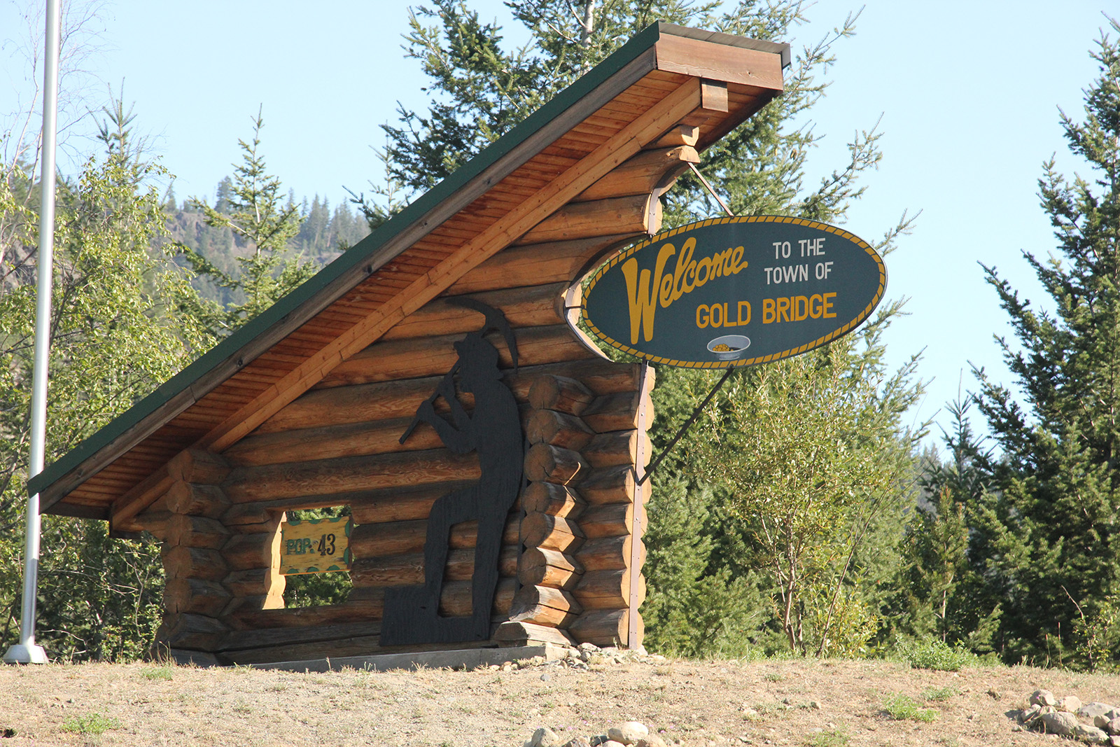
Later you pass a large dam, one of British Columbia’s first hydro dams. This one created Carpenter Lake, which you follow along the base of a high cliff. Views across the lake are good, and sometimes unbelievable. At the end of the lake, high peaks appear from behind a small mountain, and here the blue and green of the lake makes a perfect picture with the white peaks behind. Up there, a few kilometres ahead, is Gold Bridge.
You cross a bridge and soon come to the settlement of Gold Bridge, which acted as the supply town for Bralorne, at least for a while. It also contained several saloons that became prosperous from the miners of Bralorne. Gold Bridge is an old settlement perched on the side of the mountain. Its streets occupy several levels with the houses and sheds backed against the sandy gravel embankment of the mountain. The town is mostly closed, but there are a few places that show activity and during our visit, a hotel was for sale.
There are many hidden valleys, some of which had their own small settlements as prospectors found a bit of pay dirt. Most are gone now, but there are traces of their existence and are exciting to explore. This entire region is crossed with gold rush trails, although many are impassable even with four-wheel drive, but make for good hikes. There are some campgrounds here and it’s not unusual to see truck campers, small trailers, and tent trailers enjoying the trip.
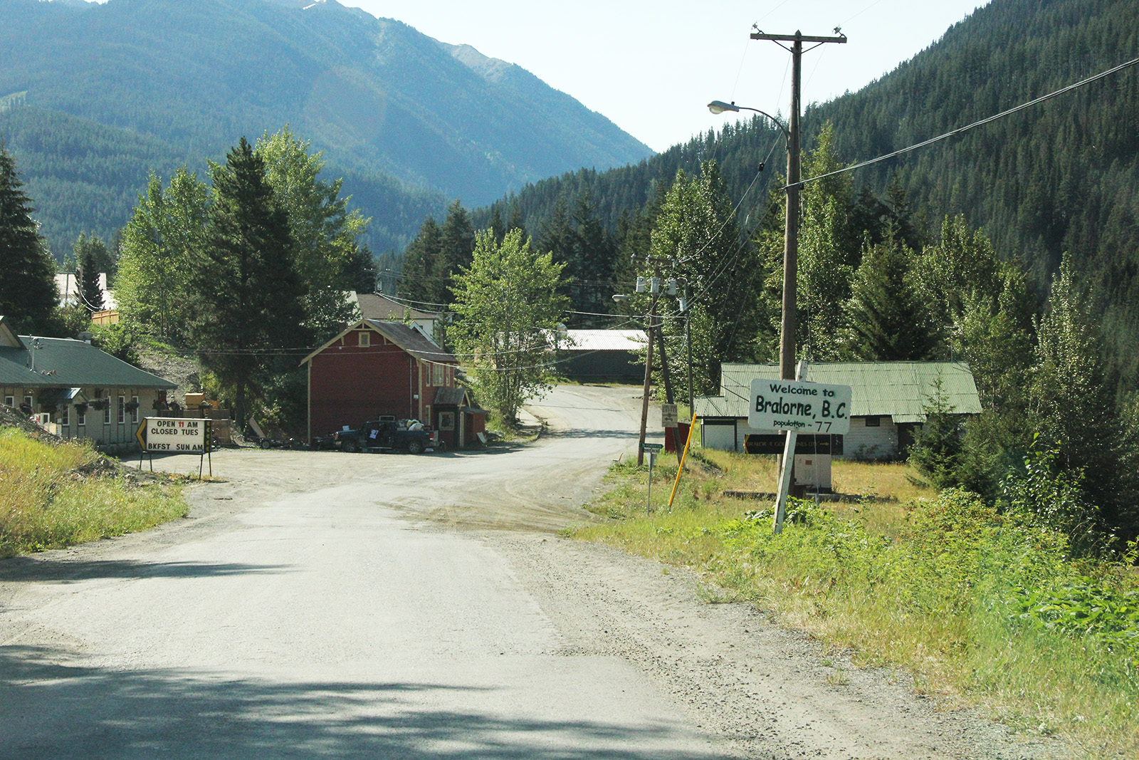
To access Bralorne, climb some of the steep switchbacks and you come to the abandoned town of Bradian. This is a ghost town but it has had the roofs repaired on the buildings for preservation and now the entire town is for sale. Just beyond Bradian is the Pioneer Mine, also a major gold producer along with the Bralorne Mine. This is all that remains of a great and profitable gold mine.
There is a four-wheel drive road out of this area south to Pemberton on the Hurley River Road which is open in summer and is reputed to be exciting and breathtaking. If you are visiting and camping in Lillooet, it may interest you that the beginning of the Cariboo Trail is here at Mile 0 and from here north, the prospectors and travellers stopped at a series of overnight stops such as 100 Mile House or even 109 Mile House. These distances were measured from the Mile 0 monument, which is presently located in Lillooet. The true location was across the Fraser River Bridge. At one time Lillooet was one of the biggest towns in the country and the largest town west of Toronto. Its position on the Fraser River makes it an important tourist destination, and of course its nearness to adventure roads into the gold backcountry draws people there as well.
There is a fine museum featuring local history and artefacts in downtown Lillooet. Rock hounds will enjoy the bare hills and cliffs along the river where it’s easy to search through the gravels for rare specimens. Jade is one of the more common finds.
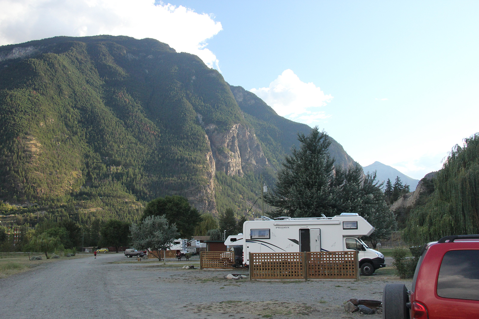
The Cayoosh Creek Campground, just down the hill from downtown Lillooet, is ideal, but noisy at times. Unnecessary engine braking on the road right above the campground was not pleasant, and it was often compounded by a helicopter just across the river, which seemed to spend a lot of time running, and sometimes coming over the campground at low level.
You can make Lillooet part of a circle drive west over the mountains to Whistler, and south to Vancouver, then return through the Fraser Valley to Lillooet. This circle tour will give you some of the best sights that South Western British Columbia has to offer. Alternately, you can head north to BC-97, stop to visit at the historic Hat Creek Ranch, before turning north for other adventures on the Chilcotin Plateau.
If you go, you will find that the backcountry (and all of its scenery) of the Bridge River Valley more than meet your expectations. Plan to stay a while. Enjoy the treat of a lifetime.
About the Author
For more than four decades James Stoness has travelled the roads of North America, photographing and writing about what he has seen. His travel articles and beautiful pictures have been published in several magazines and newspapers. He is also the author of five western novels.
Visit his website to read his novels and travel guides – https://stonessrvtravel.com/


