


By James Stoness
Northern Ontario is often overlooked by tourists. This is strange when you consider the spectacular array of scenery available there. Painters of the Group of Seven, such as A.Y. Jackson, struggled to portray the rugged boreal beauty of the north. Their efforts brought the ‘Northland’ into the homes of many and created a uniquely Canadian style of painting as well.
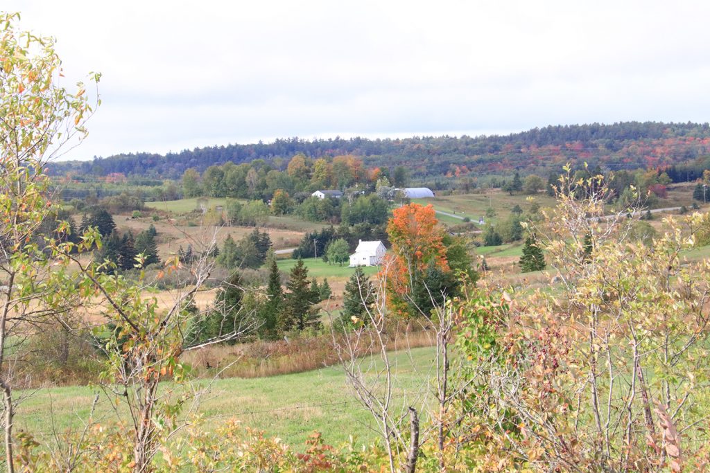
Not only does Northern Ontario have the quiet beauty of its many lakes, rivers, hills and waterfalls, it also has numerous provincial parks and campgrounds. Some of the parks are day use only and generally are found near a feature of geological interest. The north also is not highly populated and there are lots of places where you can feel as if you are the only one around. It’s a great contrast to the crowded southern areas that often offer little privacy.
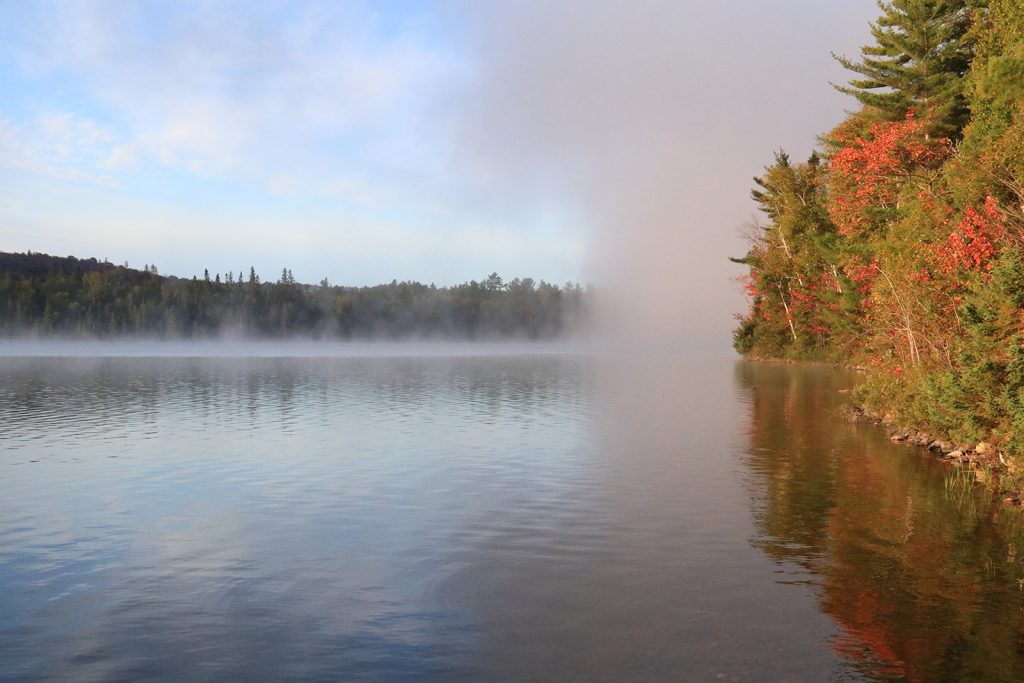
We visited Mississagi Provincial Park in the autumn almost at the end of the season. Fall colours are great anywhere in Ontario, but here in these endless rolling hills they were spectacular. Whenever we were on elevated land the panoramic views were stunning.
The rugged terrain of the Canadian Shield is the perfect setting for a few days of exploration and the 60 km of trails should keep the most ardent hiker happy. Some of these trails lead to higher observation points where you can visualize yourself striding across the hills and dropping into the valleys to discover the mysteries of the unknown. There are so many hills, and shadowy valleys beyond, that you wonder where does it end? If you come from a city environment, it’s hard to comprehend that you may be the only person present in that massive area. No doubt, there are some people who would be bothered by that lonely feeling. Keep in mind that this park consists of 4,900 hectares of forests and lakes. That’s a lot of emptiness.
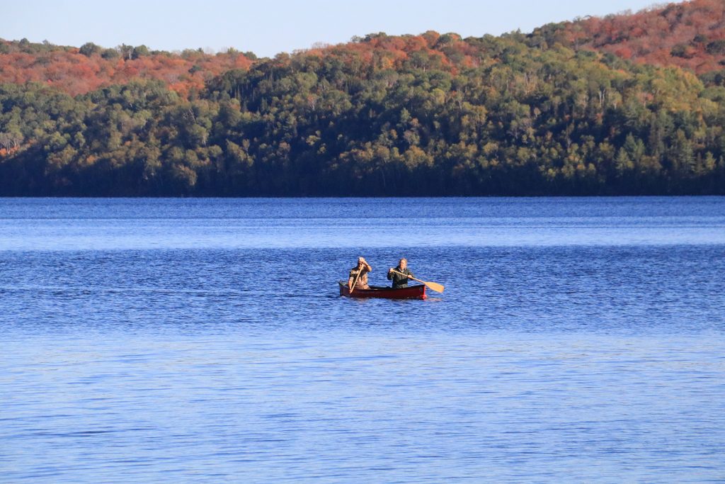
Lakes are another way to get around in the park. There are boat ramps on Semiwite Lake and at Flack Lake. Canoeing is very popular, and you can rent canoes at the park. Kayaks are also available to rent at the Mississagi Park Store. What could be better than quietly paddling the lakes and rivers in the park and the nearby rivers?
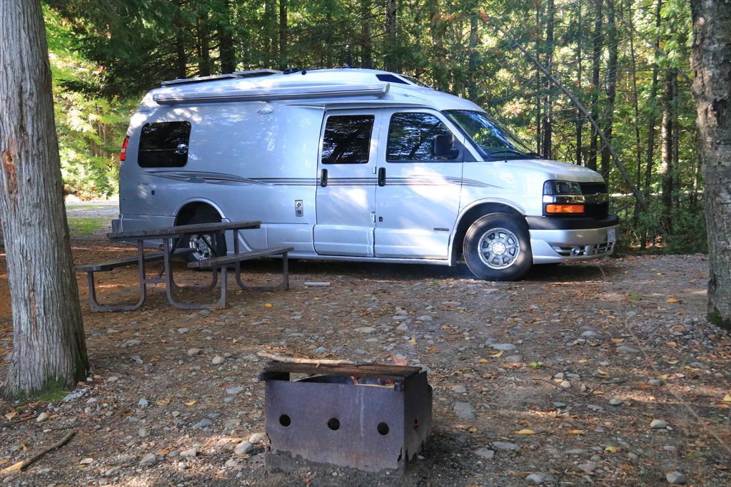
There are 60 campsites along the shore of Lake Semiwite, a long narrow lake attractively situated between thickly forested hills. These are treed wilderness sites and have enough space between them that they feel private, just the feeling of being alone along the side of a quiet northern lake. They have fire pits and wood is available from park staff. Generators are allowed from 11am until 9pm.
Many people enjoy backcountry camping. With six hiking trails at the park what could be better than to slip into the wilderness and overnight at a campsite with a firepit? This glaciated part of the Canadian Shield is rugged. Many trails wind around and climb ridges and cliffs and cross swamps. Maple and birch, mixed with pine and spruce, cloak the hills. It’s this combination that creates such a kaleidoscope of colour in the autumn. The green mixed with the yellow of the aspen, and the red-orange of the maples makes a feast of colour that will draw you from ridge to ridge seeking the next view.
The Jimchrist Trail wanders for 11 km through the forest. Suggested hiking time is six hours.
For a more arduous hike, take the Cobre Lake Trail. It’s actually 11 km north of the entrance to the park and outside the park in the Rawhide Lake Conservation Reserve. Here is a walk that will show you that the country was not always empty of humans. Along the way you will find evidence of copper exploration along with some core samples. Please leave them alone so other hikers can experience ‘discovering’ them. Near Blue Sky Lake is the old Blue Sky Copper Mine which dates from 1955. There are traces of corduroy roads that were built across boggy areas by laying logs side by side and sometimes covering them with dirt. Sunken in the wet bog these roads last for ages. Higher elevations along the trail lead to viewpoints sighting Cobre Lake, Vasseau Lake, Blue Sky Lake and Tenfish Lake.
A short 1 km trail is found at Flack Lake 3 km north of the park entrance. You will encounter an old logging camp which will explain why this area does not have any of the massive old original trees. The park has celebrated Lumberjack Days in past years with a view on life of the logging men in the early days. This was before there was much concern with saving some of the spectacular stands of old forest for upcoming generations to view.
The Semiwite Lake Trail stretches for a tough 12 km hike around the lake. It passes an old mining camp and a sign of civilization, the wreckage of a jet fighter plane that ran out of fuel and crashed here in 1946. This is isolated country and it took three weeks for them to find and rescue the pilot. Two of the backwoods campsites are along the trail.
The Semiwite Creek Trail is an easy 1.2 km walk starting from the Exhibit Centre reaching the park gatehouse.
If you are looking for something a little longer, but not an endurance hike, try the 7 km Helenbar Lake Trail. You will be walking in the woods for a lot of the time, but it rises to a viewpoint that looks down on Helenbar Lake before returning to camp.
The prize walk is the McKenzie Interior Trail. At 22 km long, plan on a few days. It is rough but rewards the hiker with many lookout points. The beginning is off the Helenbar Trail.
The lakes here are excellent for boating. Fishing is good and very popular. There are boat ramps on Semiwite Lake and Flack Lake. Canoeing is enjoyable. Imagine the silence of the canoe, only the dipping of paddle into the water making any noise. On either side are forested hills. Two of the backcountry campsites are available from the water. Voyaging by canoe can give you a good chance of sighting a moose eating plants in the shallow water along the shore. Don’t have a canoe? You can rent one at the park. Note that interior camping permits are required for the park.
Mississagi Provincial Park has been having economic problems. Apparently, the use has been too low in the past to pay its way. It was going to become a park where there would be no staff, and no maintenance. Warden Sarah Daigle spent a lot of her time trying to save the park. In the end, the City of Elliot Lake made a deal with the province to become partners in the maintenance of the park. The city was concerned that with no park, traffic nearby Elliot Lake would slow and this would affect the economy of the city. Their partnership would see the city responsible for operational costs, and staffing, and that would keep the park open for usual operations.
One effect of the shortage of operating cash is that some campsites are leased for the season. This ensures a certain amount of income that they can count on.
Getting to the park:
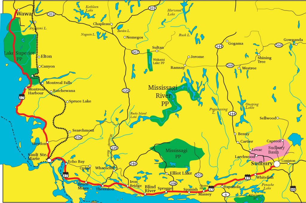
The most direct way is from Trans-Canada Hwy 17 north to Elliot Lake and beyond. This is a fine drive through rugged wilderness and forest. Elliot Lake is an easy spot to stop and pick up supplies for the visit to the park. The park entrance is on the east side of the highway.
You could also follow the Deer Trail by turning off Hwy 17 at Iron Bridge and going north on Ontario Hwy 546. Be prepared for many twists and bumpy pavement on parts of this road. This is a region of endless lakes and rivers and is a nice drive for scenery. There are several side driveways leading to private cottages on lakes. For a long distance you follow the Little White River with tall hills on either side. When you reach Hwy 639 turn south until the park entrance on the east side of the road.
We enjoy driving and discovering new roads in the north and so we took an even longer route. We went north on Hwy 17 from Sault Ste. Marie and turned off on Hwy 556. Along the way we turned up Hwy 532 to visit the little community of Searchmont before continuing.
This area is popular for mountain biking, and hiking. There is also canoeing and kayaking on the Goulais River which meanders through a valley bordered by high hills. Searchmont Resort (www.searchmont.com) located here is a fantastic ski hill with over 20 runs, a vertical drop of 700 ft and plenty of winter activities. It offers mountain biking and hiking in the summer.
The Agawa Canyon Tour Train (http://www.agawatrain.com) follows the river here and passes on the now historic Searchmont railway bridge. The Group of Seven artists rented a boxcar and used it for headquarters in various places. This enabled them to get to the wilderness areas they dearly loved to paint.
Highway 546 turns into a rough gravel road for many miles, called the Ranger Lake Road. It could have been very scenic, but it began pouring rain and the road became muddy and rough. But we did enjoy the experience.
When the road meets Hwy 129 you go south towards the small community of Thessalon. This is a good paved road that passes through the hills, not too crooked nor hilly. Turn across to the Deer Trail and follow it to Mississagi Provincial Park.
Mississagi Provincial Park is the perfect place for those thinking about wilderness camping. It’s close to Elliot Lake for supplies and medical aid. It’s a quiet park except if generators are being run. It seems to be a great place for experienced and non-experienced campers. Give it a try and enjoy some time in the ‘Northern Wilderness’.
Mississagi Provincial Park: https://www.ontarioparks.com/park/mississagi
RV Lifestyle Magazine’s Travel Editor, James Stoness, is the author of ‘Touring North America’, a series of travel guides on CD and online to help you plan your trips across North America, as well as a series of novels. Visit his website to read his novels and travel guides – https://stonessrvtravel.com/


