


")
The Canadian Prairies are huge and if you are crossing from points east of Winnipeg, many will say they are wide and boring. That’s not true. If you stay on the TransCanada highway you might soon tire of wheat and canola fields, but if you are out for adventure you can encounter a kaleidoscope of different landforms.
Starting at Brandon, Manitoba, this trip takes you to see more than wide farms.
Brandon is located along the meandering Assiniboine River. Some of the meanders loop so wildly that in flood season the river simply goes across the narrow neck of land cutting a new channel. There are several oxbow lakes that show historic river channels. Brandon is developing a trail system following the 17 km of the river in town. In places, it’s paved, and in others, it passes through trees and marshland. If you stopped at Meadowlark Campground, right along the Can-1 highway, you might go in town to stroll along the pathway or take a long bike ride.
Around Brandon the fields are huge and if you are there when the crops are ripening, the rolling wheat mirrors the waves on an ocean. Wheat is not the only crop and sometimes the fields are very colourful with a mixture of blue, green and yellow.
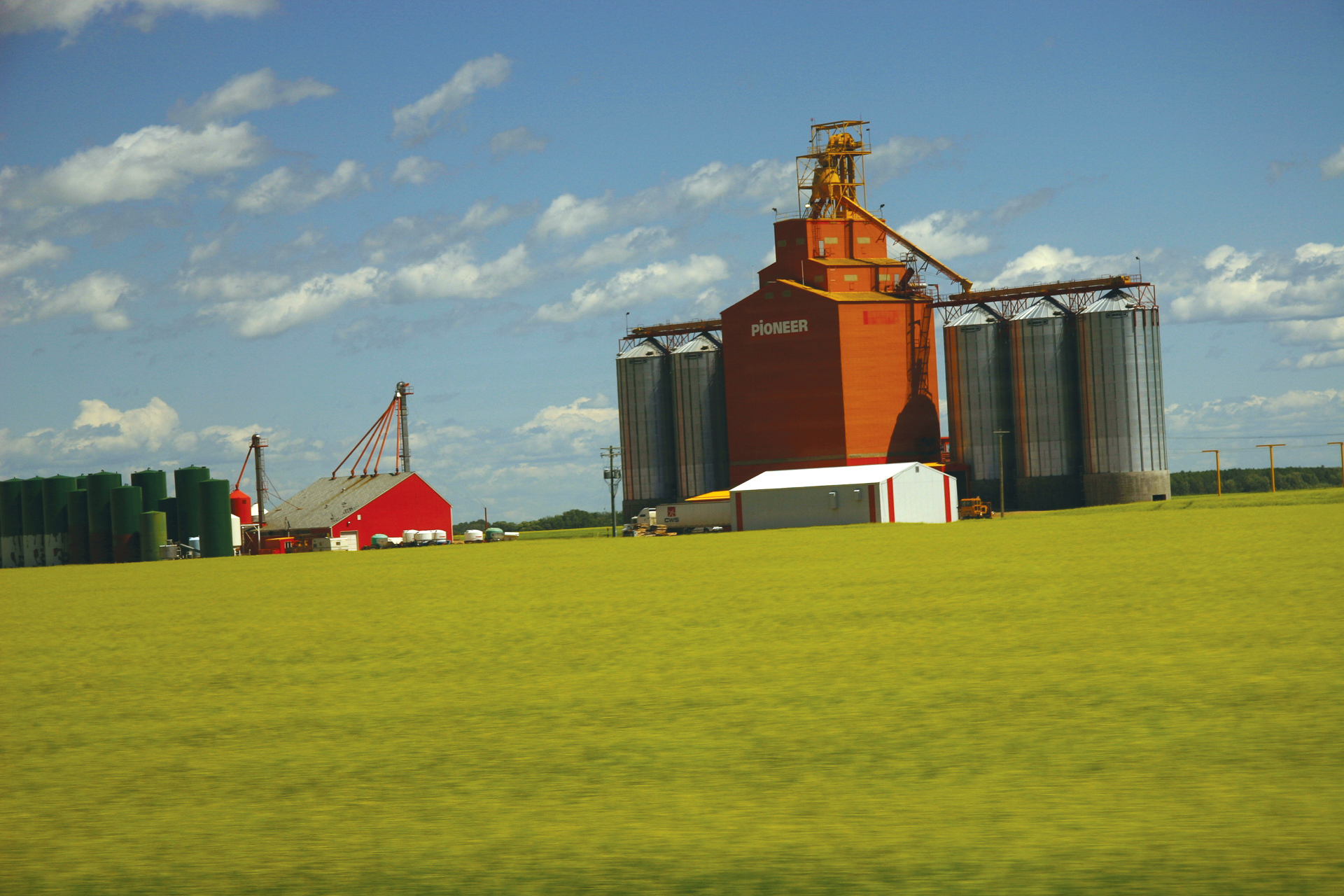 Now, for many miles you drive through grain farms, and the route is broken by many small towns, some still with the characteristic big grain elevators. The iconic wooden elevators are becoming scarce and are being replaced with steel-clad structures and cement silos.
The land slowly changes as you head west. Fields are often rolling and there are numerous wet holes or sloughs. These are great for wildfowl, but not good for big machinery that would rather proceed in straight lines instead of circling wet areas. The flat prairies are usually rolling land, and in some places near streams and rivers, there will be deep gullies and extensive erosion.
From time to time, you will get a whiff of a distant gas or oil well. Moosomin, SK flourishes from an industry of potash mining, farming and oil and gas.
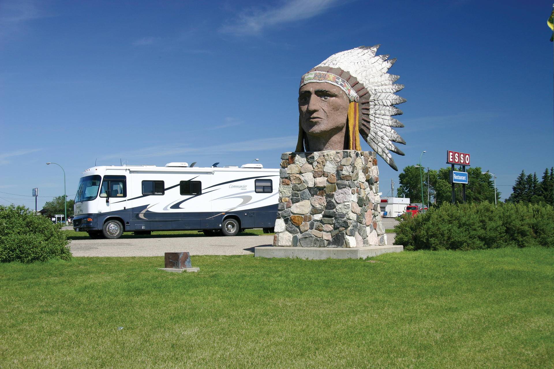
North of the highway is a section of badly dissected land with small streams that run into the broad Qu’Appelle Valley, and you turn north at Indian Head heading for the valley on Sask-56. At Indian Head, the Indian Head Campground is a handy stop.
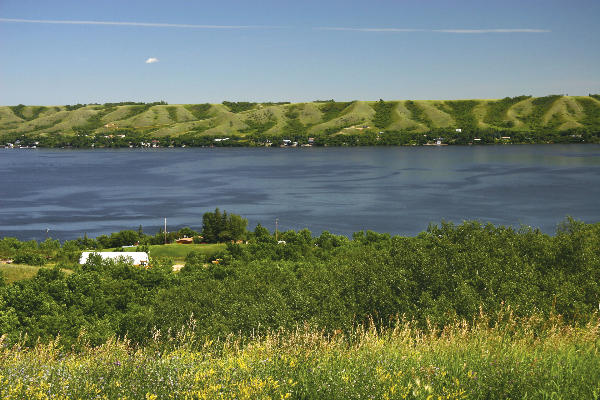
As you leave the big statue of an Indian head at the community of Indian Head you drive through more large flat fields until a line of bluffs comes into sight. Then, with little warning, the Qu’Appelle Valley appears with the sudden deep blue of one of the lakes. All around the lake are houses and a nearby golf course. The descent is about 9%. This is an excellent hill from which to take pictures of the valley.
Drive along the small lakes called The Calling Lakes, which consist of a chain of lakes, Katepwa, Mission, Pasqua, and Echo Lake. They provide camping, fishing, and swimming. The lakes gained their names from a legend which Pauline Johnson made into her famous poem. The story deals with an Indian on his way to marry his intended. As he paddles on the lake he hears someone twice call him. He calls out across the water, “Who calls?” and repeats it in French, “Qu’Appelle?”. He gets no further reply but upon reaching her village, he finds she has died, but not before calling him, twice. The road along the lake may be narrow, but the drive is pretty.
Near Katepwa Lake there is a viewpoint along the Qu’Appelle River that tells about gouges in the soil caused by icebergs that were floating on a great glacier lake and their bottoms dug into the soil here causing glacial grooves up to 5 metres deep. These are similar to those in the area south of Lake Winnipeg. Farming has changed them, making them more difficult to see from the ground.
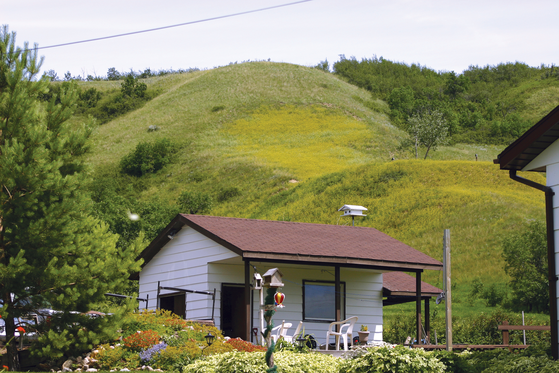
Near Lebret, you can see the hummocky shape of the Lebret Landflow. This slowly moving hillside is an example of an unstable hillside. Sometimes all it takes to get them moving is the removal of soil to build a road or remove gravel from a quarry. Lebret is a small, neat community with two nice looking churches. This road would be more comfortable for a car, rather than a larger RV. It’s also a busy road.
Echo Valley Provincial Park has over 300 campsites and is a heavily used park. Near the visitor centre you will find glacial erratics, heavy rocks transported by the glacier a distance of 300 km from their place of origin. The valley, created 70 million years ago, was filled by a glacier, eroded open again, filled by another glacier, and as the last glacier melted, the rushing waters cleaned it out.
From here we can follow Sask-10 south to the TransCanada Highway and head west through Regina, and Moose Jaw to Chaplin and then north to Lake Diefenbaker.
In the midst of the flat prairie, you come to Pile O’Bones, now the capital of Saskatchewan. Of course, it had a name change to Regina, the Queen City. The original name was derived from the buffalo bones that were collected and piled in a heap. There were many buffalo jump areas where the Indians drove herds of buffalo over a cliff and then harvested the meat. That, of course, left a lot of bones, and later the white men slaughtered herds for the hides and left the bones on the prairie floor. The bones of the native buffalo were collected and later shipped east for processing.
Regina preserves the childhood home of Prime Minister Diefenbaker, who led the nation from 1957-63. The city is also home to the Royal Canadian Mounted Police. The RCMP are famous for their Musical Ride – a very popular event.
Between Regina and Moose Jaw it is very flat, with large fields and few trees. Moose Jaw is sitting over a hot spot in the earth’s crust where waters that circulate through the fractured rock get heated and rise towards the surface. The city has drilled into these hot waters and uses them for heating.
Over a period of years, a system of tunnels grew below the surface of the city, and during the years of alcohol prohibition liquor was hidden in the tunnels and they were used for other activities as well.
This city is also the home base for the Canadian aerobatic team, the Snow Birds. This precision team has flown in air shows all across Canada.
West of town it becomes hillier, and trees are replaced partially by brush. Ranching becomes more noticeable and the flatness is replaced in places by hummocks of earth.
Sodium sulphate is an important product in the production of paper, livestock feed, and detergents, as well other minor uses. Here in the Chaplin area, the material is found as sodium sulphate salt mixed with mud in Lake Chaplin. It is recovered by adding fresh water to the lake. As the water warms the sodium sulphate dissolves into the water. The solution is then pumped into shallow pans and the salts crystallize out when the ponds cool in the fall.
There are several salt lakes in the area. You may see white piles of the material. The road north is a hilly and crooked road.
At Lake Diefenbaker, you will find Douglas Provincial Park, named for a past Premier, Tommy Douglas. Here are swimming and boating opportunities on Qu’Appelle Bay. There are about 150 campsites here and several hiking trails. Nearby is the Qu’Appelle Dam, one of the two dams that control Lake Diefenbaker.
The road passes through very hummocky land and much brush. Eventually, you come out on top of a plateau that has many large fields and grain elevators. Farming has been hard on many of the people as confirmed by the number of empty houses and abandoned farm buildings that you drive past. The road improves as well. Elbow, SK is in an area of several grain elevators and good farms.
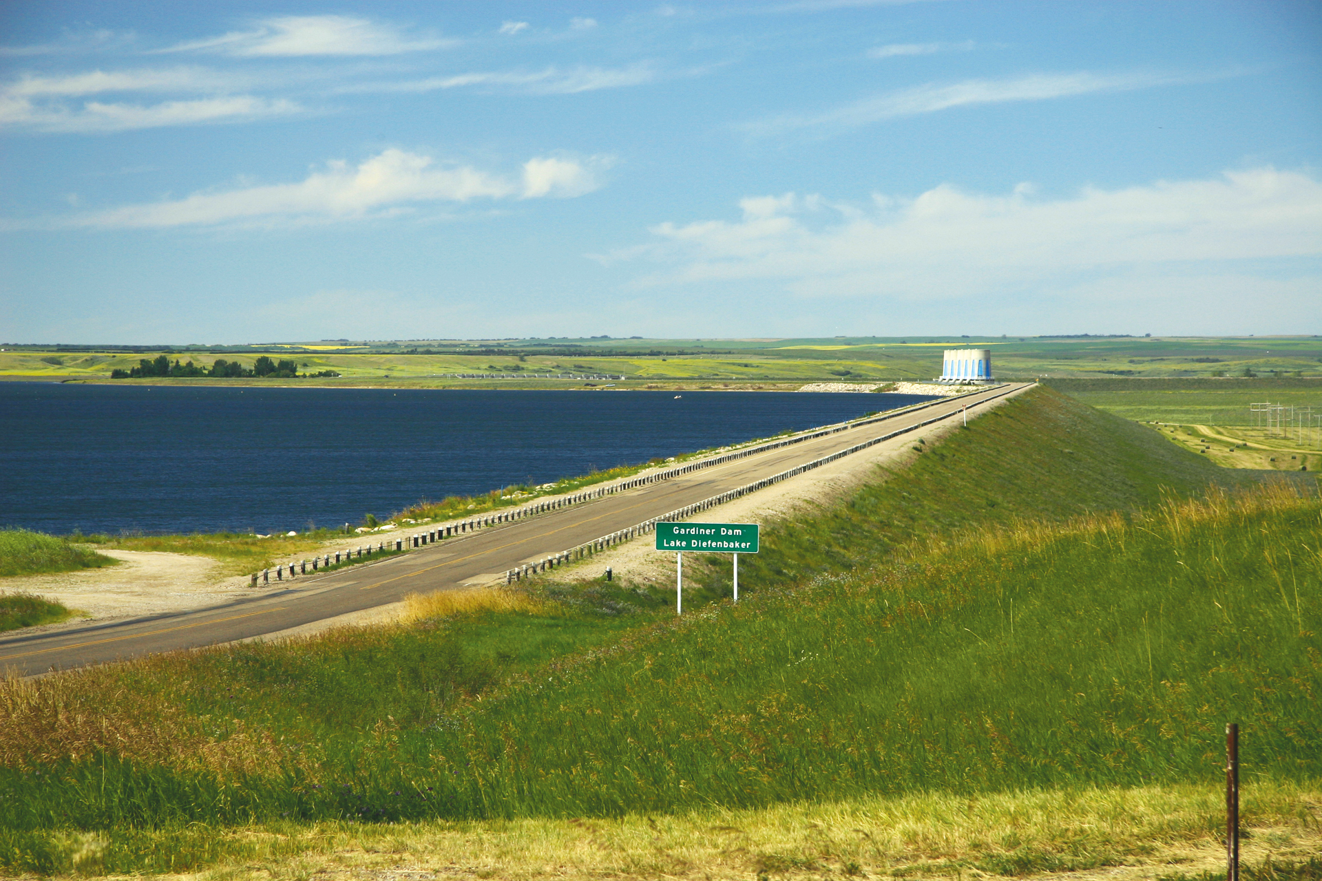
Lake Diefenbaker, named after former Prime Minister Diefenbaker, who was the first prime minister from Saskatchewan, is a huge reservoir whose water is used for mining, irrigation, and a vast number of other uses.
Gardener Dam, at 64 metres high and 5,000 metres long is one of the earth’s largest earth fill dams. It required over 9 years to complete and created a reservoir that is 222 kilometers long.
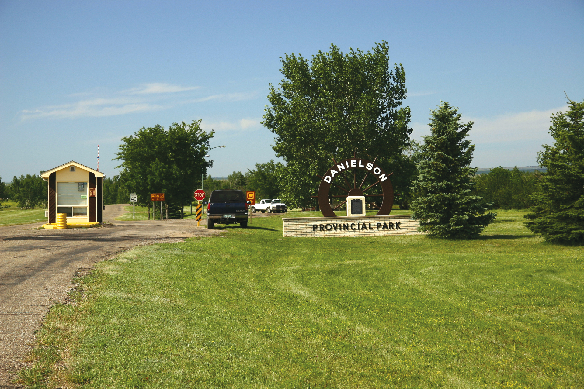
Danielson Provincial Park is located on the South Saskatchewan River near Gardener Dam. It has approximately 100 campsites that give you an opportunity to explore the vast waters of the lake, or enjoy swimming at the beach. The lake has become a popular area for fishing. This is a nice park.
Saskatchewan Landing Provincial Park is set amidst rolling hills and steep valleys. The location is one used by early tribes to cross the South Saskatchewan River. In 1883 a man established a ferry crossing. After several short-lived spans, a permanent bridge now crosses the river.
Head across Gardener Dam and reach the town of Outlook. Here the citizens have created a trail high above the river using an old railway trestle. Built in 1911 by the CPR the bridge was 914 metres long and stood 48 metres above the water. At the time, it was the second largest railway bridge in Canada and had the highest concrete piers anywhere. The bridge is now part of the Trans Canada Trail.
Sask-219 is rough and narrow, but it goes through interesting scenery and takes you straight into Saskatoon to the Western Development Museum. There is no easy way to reach a highway that will avoid it. Drive slowly and enjoy the wide variety of landscapes.
Saskatoon is called the ‘City of Bridges.’ With seven bridges crossing the South Saskatchewan River, it’s an appropriate name. Some of these bridges are quite nice to look at. At the Diefenbaker Centre, you can visit the grave of former Prime Minister John Diefenbaker and see exhibits about his life and the many fascinating events of the era.
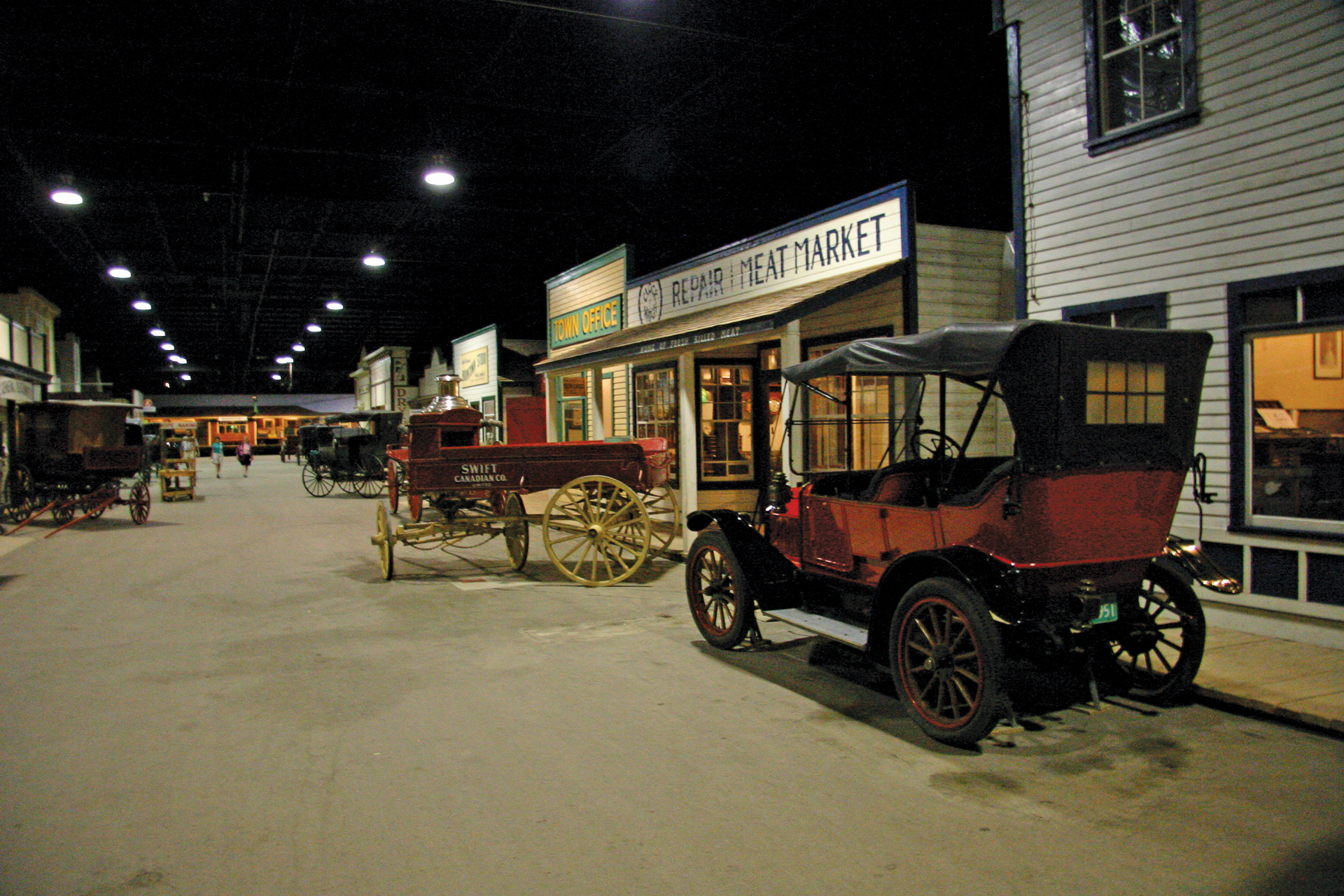
The Western Development Museum’s Saskatoon branch, called ‘1910 Boomtown,’ displays an early town of the prairies, buildings, and the equipment that farmers would be using at that time.
In case you didn’t know about it, you might enjoy Little Manitou Lake near Watrous, which is a bit out of the way. There is a small local park here suitable for large RV’s. Little Manitou Lake is a deep spot in one of the channels created by the melting glaciers. What’s really unusual about the lake is the density of the water. Almost anyone can float in this lake. Of course, as with any mineral water body, it’s reputed to cure most anything.
This drive ends at Prince Albert, Gateway to Prince Albert National Park. Your drive across the Canadian Prairie can be as interesting as you make it. Leaving the tedium of the TransCanada lets you enjoy the hidden treasures of the prairies.
RV Lifestyle Magazine’s Travel Editor, James Stoness, is the author of ‘Touring North America’, a series of travel guides on CD and online to help you plan your trips across North America, as well as a series of novels. Visit his website to read his novels and travel guides – https://stonessrvtravel.com/


