


“Gold! Gold! They found lots of gold.” That yell was echoed across the country, especially into the USA. Soon, the Klondike, of the Yukon, became the target of thousands of men searching for quick riches.
It’s useful to know where the Klondike is located. Frequently we hear from southern foreigners that it lies in Alaska. Remember the song ‘Saginaw Michigan’ by Lefty Frizzel?
‘I’ve hit the biggest strike in Klondike history…
Now he’s up there in Alaska digging in the cold, cold ground’
So, like many others, the writer dislocated the Klondike.
In 1896, prospector George Carmack, and two indigenous men Skookum Jim and Tagish Charlie, were probably on a combined fishing trip and prospecting trip. Carmack had tired of fruitless prospecting in Alaska and came to the Yukon to try his luck. On Rabbit Creek, Skookum Jim spotted the gleam of gold and the rest is history. When two tons of gold arrived by ship to USA ports the secret was out.
 During the last ice age a bridge of land between Asia and North America became exposed, caused by water evaporating and forming snow that created the massive land glacier over the north. This caused the sea to lower. People used this dry land route to enter North America and spread eastward and southward. This would have been back 12,000 years. At that period of time the woolly mammoth lived in the north. Strangely enough the continental glacier did not totally cover the Yukon. It would have been cold, but there were lots of animals for skins and food.
By the end of the 1700’s fur trapping and trading brought many newcomers from the south to make homes there. They were followed by prospectors looking for mineral deposits, especially gold, but the hordes did not arrive until after Skookum Jim’s discovery.
 Reports suggest up to 100,000 people left their homes, and their jobs, to head into Canada’s north. Many fell out along the way, broke, and penniless, or died from exposure and diseases. Of course by the time the word of the discovery got down to civilization the prime sites had been claimed leaving only slim pickin’s for the newcomers. It wasn’t long before large companies purchased the claims and moved in with heavy equipment. Many of the newcomers stayed a while, and discouraged, made the treacherous journey back towards home. Jack London, author of, ‘The Call of the Wild’, was one of those who was unlucky in gold but became very successful in writing.
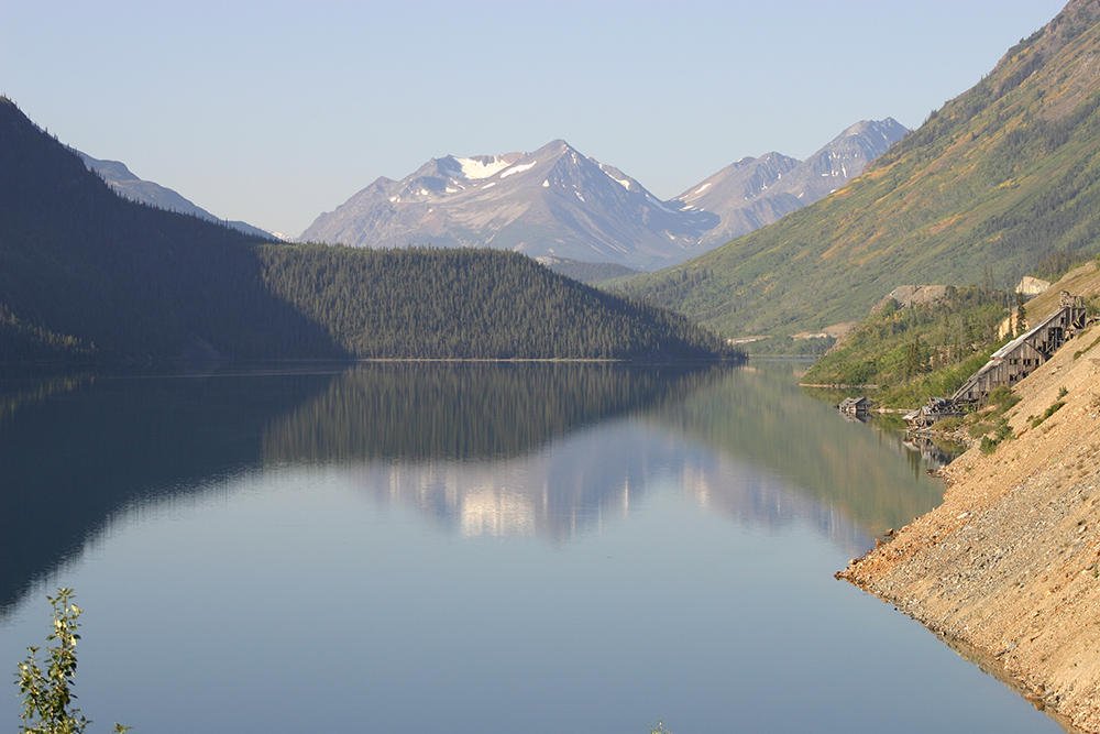
Getting to the gold streams was a challenge. Many boarded a steamer at Seattle which took them north along Canada where at last they entered the long, long fjord called the Lynn Canal. It was a glaciated gorge cut by the glacier coming off the mountain and scouring out the channel under water. It has nothing to do with a canal.
 They then disembarked at the small port of Skagway, Alaska. Ahead of them lay the mountains. The Chilkoot Trail climbed to Chilkoot Pass and then led on to Bennett Lake in Canada. Bennett Lake is the headwaters of the Yukon River.
Much is written about the Chilkoot Trail, but the simple story tells about how rough a trip it was. The Canadian government did not want to support hundreds of people so the travellers were compelled to have a ton of food and supplies with them, and that was monitored at the customs station at the Canadian border. That meant that all that weight had to be packed up the trail. It meant leaving supplies at the border and returning again and again to the bottom of the hill for your load until it was carried over the mountain. Horses died by the hundreds by overwork, weather, or just falling off the trail, where they stayed. Many travellers died as well.
 Once over the summit they traipsed their loads to Bennett Lake. Here they assembled boats and rafts for the 1300 km trip to Dawson City. Enterprising people were here to meet them and offer them their services to build boats, or rafts and perhaps guide them. They would make more money than most of those on the trail.
A great song about the Yukon is sung by Hank Karr, ‘After Yukon’. Hank Karr is a Saskatchewan born Canadian who has made the Yukon his home. His wonderful voice is perfect for featuring his love of the Yukon.
Of geological interest is the white layer of ash that you can see in places along the Klondike Highway. It’s the result of a massive volcanic eruption of a mountain in Alaska about 1,000 years ago. There are places where the layer may be as thick as half a metre. This ash drifted as far as 7,000 km from the erupting volcano, which is a long way for a North American volcano. Try to imagine the situation in the Yukon with the ash coming down so thickly that it would still be visible today.
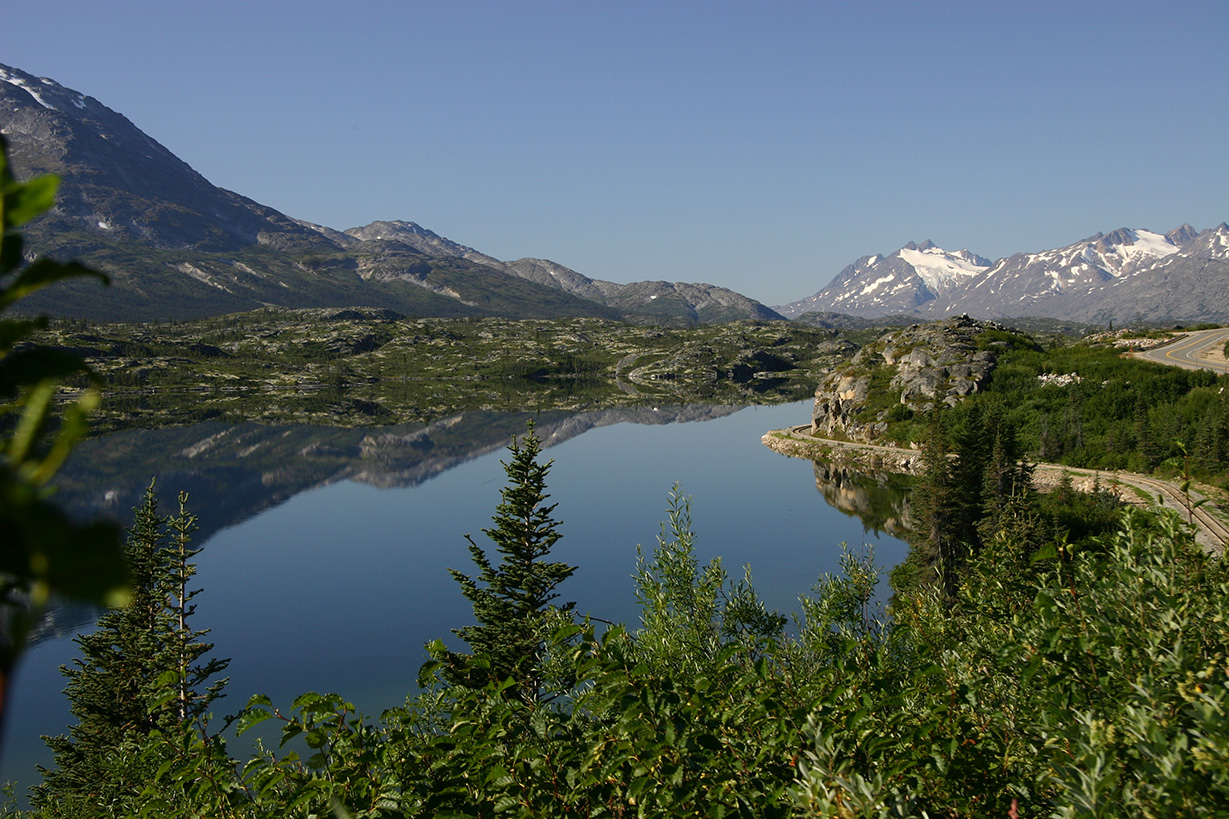
 From Whitehorse there is a beautiful drive to the Port of Skagway. You will need passports to cross the border. You are climbing in comfort over the mountains that caused so much trouble for the gold seekers. Take lots of time. The mountain and lake views are fabulous on a bright day. If you like, you could also book tickets on the White Pass and Yukon train for a very spectacular ride up and over the White Pass Summit to Fraser where the railway touches the South Klondike highway. The tour guide points out the historical points on the old trail. The train company offers a variety of choices for your tours.
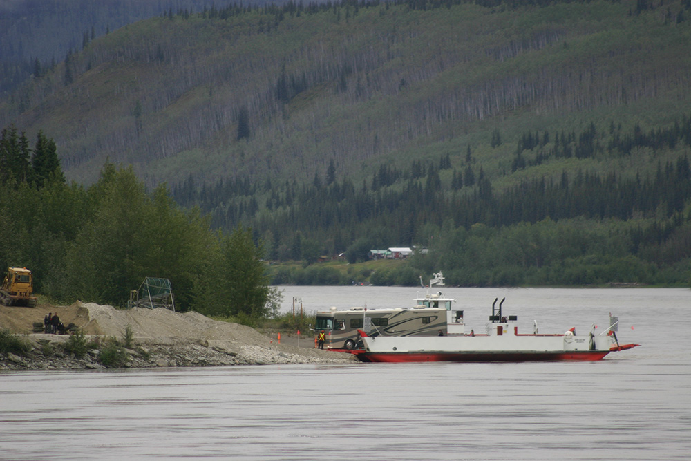
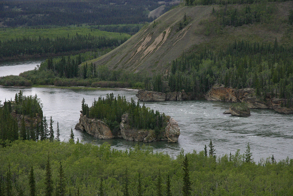
As you drive from Whitehorse to Dawson City the fine scenery continues. North of Carmacks pull off to see the Five Finger Rapids. The river is segmented by 4 islands creating narrow channels of which only one is navigable. Many deaths occurred by those who selected the wrong channel.
Dawson City, at last! You have to wonder if those were not the words of every gold seeker who finally reached Dawson City, whether by land or by the river. This was the goal. Come and dig gold and get rich. For the late comers, that didn’t happen very often. A lot of people did make money by offering services to the travellers. Those who set up saloons almost had a licence to print money. Their tables offered a meagre chance to make some money, and the shows were a change from the rugged outdoor life many had suffered for many months.
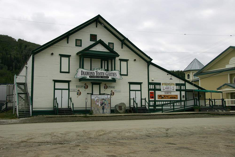 Today, most of the travellers will stop at Diamond Tooth Gertie’s Gambling Hall to enjoy an old fashioned vaudeville show.
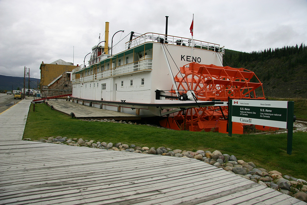
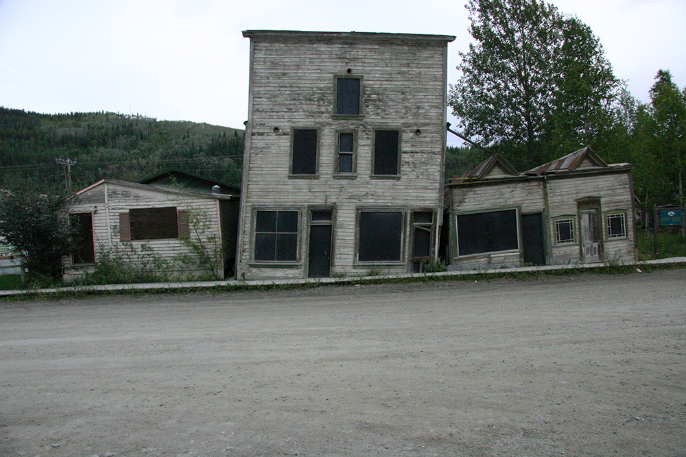 Downtown Dawson City continues to have the rustic appearance of the 1800’s. Some buildings have sunk into the ground, and a few have a tilted lean to one side. It’s a fine experience to tread on the steps of the gold seekers. This area is a National Historic Site of Canada and there are also several more NHS sites in the surrounding area.
Do you remember ‘The Cremation of Sam McGee’? Many of you can probably recite some of this famous poem written by Robert Service. He wrote many stories and poems about the north. Take time to visit the Robert Service Cabin, now a restored heritage site. Inside are many of his personal items such as his desk and tools.
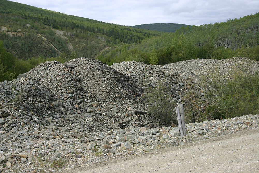
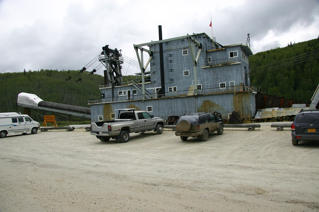 You will definitely want to visit the discovery site on Rabbit Creek, now called Bonanza Creek. You should also stop at Dredge #4, to see the monster dredge that removed a lot of gold while destroying the stream with rows and rows of rock and sand. The staff there describe how the dredge dug a hole that filled with water to float itself, then continued to nibble away at the surroundings sending the gold bearing gravel up a conveyer belt and across screens to separate the gold, then sending the waste rock and sand out into dump piles.
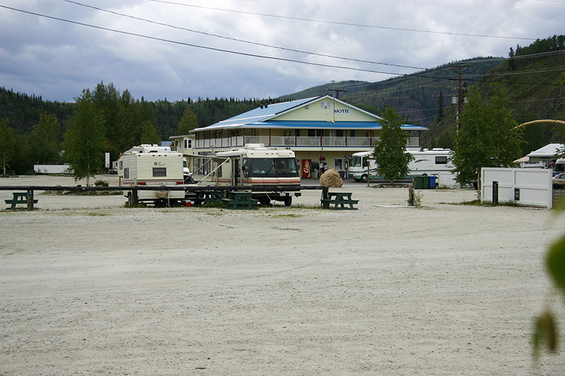
There are several campgrounds nearby, so it’s easy to get setup and then drive downtown. If you have a vehicle to drive downtown it’s simpler than trying to find a place to park a larger RV, especially when it’s a busy time of year.
 For an adventure, take a drive north on the Dempster Highway through some absolutely stunning mountain scenery, especially in the autumn. It’s not a road for everyone. It’s 750 km from Dawson City to Inuvik, Northwest Territories, on a mostly gravel road. It can be muddy in wet seasons, but we found it a highlight of our trips. Now, we must return, because the extension to the Arctic Ocean at Tuktoyaktuk is now complete, but adds another147 km to an already long drive.
Many people rent canoes for a chance to paddle a quiet river amidst the towering mountains and through the wilderness. It’s a place where a person can retreat from civilization, but you will be on your own and you must solve and problems without expecting help to be just around the next corner.
 Kluane National Park is edged by the Alcan Highway (Hwy-1). Mount. Logan, 5,959 m, Canada’s highest mountain is located in the park. This is a park with great peaks and glaciers, some reached by the many hiking trails. Some of these are trails for the rugged individuals used to the back country.
For many travellers, a trip to the Yukon is likely a once in a lifetime experience. However, it’s an experience you’ll never forget. Scenery is topnotch. Plan ahead and go!
For More Information:
‘After Yukon’ by Hank Karr: https://www.youtube.com/watchv=WEu5U_QoJEk&feature=emb_title
Yukon Map: https://yukon.ca/sites/yukon.ca/files/env/env-guide-camping-yukon-map.pdf
The Train: https://wpyr.com/excursions/
Kluane National Park: https://www.pc.gc.ca/en/pn-np/yt/kluane/visit
Dempster Highway: https://www.dempsterhighway.com/maps-guides
RV Lifestyle Magazine’s Travel Editor, James Stoness, is the author of ‘Touring North America’, a series of travel guides on CD and online to help you plan your trips across North America, as well as a series of novels. Visit his website to read his novels and travel guides – https://stonessrvtravel.com/


