


By James Stoness
Lead photo courtesy of Fairmont Hotels
Quebec’s north shore along the St. Lawrence River has everything you need for a great holiday. Whether you are looking for small villages nestled in green valleys, or the bustle of the large city with its theatres and shopping areas you will find everything here. You will also find terrific panoramic views of the St. Lawrence River, backdropped by tree clad mountains, and rugged canyons.
Quebec City draws people from all continents. The historic battlefield that shaped the future course in Canadian history is preserved in the Plains of Abraham and is a beautiful open park great for walking, having a quiet picnic, or exploring the history of the battles. Of course, everyone wants to visit the old walled city of Quebec enclosed with its 4 kilometre stone wall. Once you enter one of the four gates you are surrounded by well maintained historic stone or wood buildings dating back to the beginning of the city. It’s a delight to walk the narrow, twisting streets and sample the wares of the small shops. No visit is complete without descending from the high plain upon which the city is located to the lower level by the river. Here there are more narrow streets and lanes with small shops and places to eat, and an unforgettable view of Chateau Frontenac. This uniquely designed hotel with its red walls and green copper roof is Quebec City’s most recognizable building. It was built by the Canadian Pacific Railway as part of a chain of magnificent hotels built to attract tourism and increase passenger traffic on the railway.
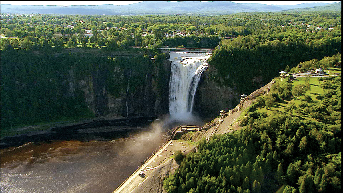
Driving a few minutes to the east you reach the 83 metre high Montmorency Falls. This spectacular falls is now part of a park with hiking trails, and picnic areas. The top of the falls is reached with a long climb on a cliff hanging set of stairs, or in the comfort of a cable car.
The striking view of the river at Baie Saint Paul coaxes you to leave Que-138 and turn onto the Shore Road, Que-362, a road that descends along fields of hay and grazing cattle, passing quiet villages along the way. Not only are you passing through an area of great beauty, but it’s also a region that’s seen its share of dramatic changes. You will drive through the 54 km diameter Charlevoix crater which probably reached 10 km deep. This crater was formed when a meteor struck many millions of years ago. The crater spreads out under the river. The drive has steep hills 7-13%. Some of Quebec’s great water photographs are taken from this highway. Mont des Eboulements is the small mountain created by the meteor’s impact. Below the village of Eboulements is the village of St. Joseph de la Rive located on the landslide of the earthquake of 1663. The road to it is steep and space is limited in the village. This area is a high earthquake occurrence zone.
In 1608, the explorer Samuel de Champlain was less than pleased when the tide went out and left his ship stranded on the bottom of the beautiful bay he was visiting. La Malbaie takes its name from Champlain calling it ‘Malle Baie’ or bad bay. To the traveller it looks far from bad. It’s just a continuation of the wonderful scenery found along the river. In the 1800’s the rich and famous took advantage of the beauty of the area and flocked here for vacations.
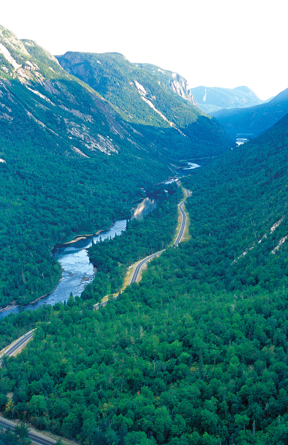
If you are looking for rugged mountain hiking, paddling and camping, visit the provincial park (park national des Hautes-Gorges) on the upper reaches of the Malbaie River. This park features very deep valleys with sheer cliffs and high mountainous peaks.
Que-138 heads east from La Malbaie through scenic, hilly country with good views of the river below. You can stay on this highway and cross to Tadoussac on a ferry. It is perhaps better to follow Que-170 towards Chicoutimi because it takes you along one of Quebec’s scenic jewels, the magnificent Saguenay Fjord. The highway is twisty as you reach the high cliffs of the Palisades of Charlevoix and pass attractive lakes before reaching the edge of the Saguenay Fjord in L’Anse-Saint Jean. This is one of Quebec’s pretty villages and its setting and the style of the buildings are worth seeing. While in the village, cross the covered bridge and drive upward to the edge of the Saguenay Fjord for great views. It may not be good for large vehicles as space is tight.
Near Riviere Eternite turn into the Saguenay Provincial Park which encloses the greater part of the Saguenay Fjord. This is one of the longest fjords in Canada and you can board a cruise boat here to see the cliffs from water’s level. The waters of the fjord and part of the St. Lawrence Estuary are protected by the Saguenay-St. Lawrence Marine Park managed by the Federal government and the Quebec government. The campground is at the base of the striking cliffs of the park. The Visitor Centre is further down the entrance road on the waters of the fjord. Take a cruise to fully appreciate the height of the sheer cliffs along the fjord.
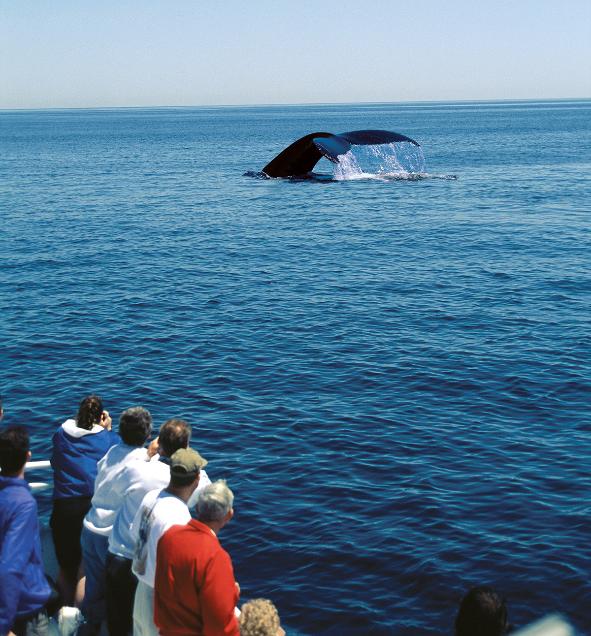
When you leave the park, drive through Chicoutimi and then southeast along Que-172 to reach Tadoussac. There are fewer hills along this route and unfortunately you are too far from the fjord to see it. Tadoussac is at the mouth of the Saguenay River where it enters the St. Lawrence Estuary. An estuary is a zone where river waters meet ocean waters and the mixing of two different kinds of environments takes place. High levels of nutrients are present creating a perfect habitat for marine life. Here you will find whales of many different species and it’s for this reason that Que-138 is called the Whale Route (Route des Baleines), a distance of over 900 kilometres where whales are frequently present.
Tadoussac is a perfect port from which to take advantage of a whale watching cruise. You’ll also find that the Domaine des Dunes is a nice clean campground and very handy to the boat cruises with a shuttle bus stopping in the campground. A short sidetrip takes you to an area of large sand dunes. Tadoussac was first visited by Europeans when Jacques Cartier anchored there in 1535. A fur trading post was established in 1600 and was visited by Samuel de Champlain in 1603. From these simple roots came the Canada we know.
Two hundred kilometres north of Baie Comeau you would reach the Manicougan Impact Crater and Reservoir. It was a 5 km wide meteor that struck here 200 million years ago forming the 4th largest impact crater in world, 104km by 138km. It is easily visible from the air, and the water impounded behind the Manic V dam produces immense quantities of electricity. There is an excellent tour of the power plant and dam.
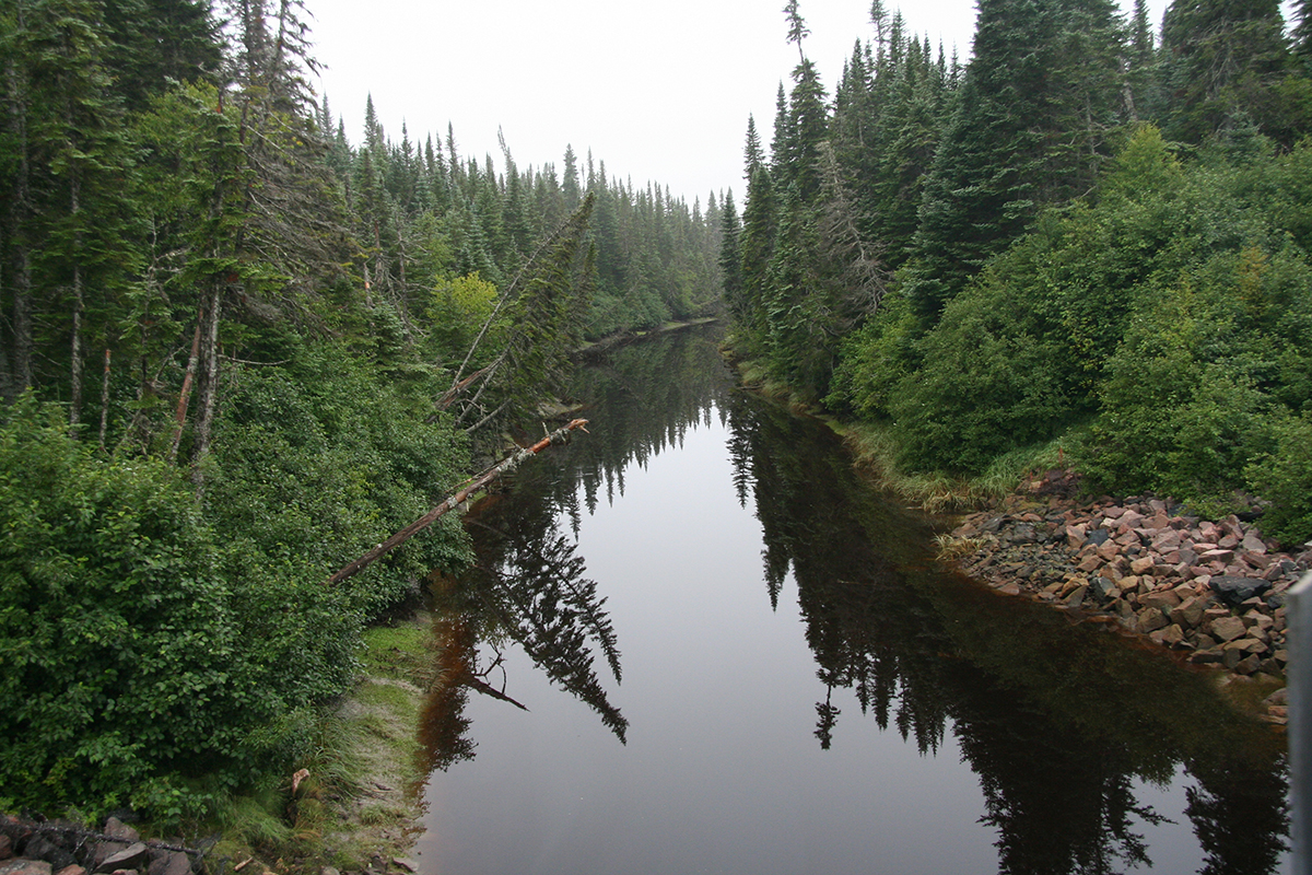 The Whale Route in places cuts through heavy dark forests with occasional views of the estuary, or twists among beetling cliffs and roams up and down steep hills. It is quite scenic. To the north of Port Cartier there is an enormous wildlife reserve with a large number of fishing lakes, many of which are part of canoe camping routes.
The city of Sept Iles was named in 1535 by Jacques Cartier after the seven islands that protect it. It is now an important year round shipping port shipping out iron ore brought to it by rail from Labrador. Cheap electricity also made it possible to build a huge aluminum smelter here.
Havre St. Pierre gives access to the Mingan Archipelago National Park Reserve, a chain of islands and bays stretching over 150 kilometres. It features distinctive topography of arches, pillars, and sea caves. It is also a place to see over 200 species of birds. You can make arrangements with private operators to take you to the islands or tour them.
Havre St. Pierre is also a shipping port for titanium ore. A 45 km railway brings the ore from the mine to the port. A visit to the dock will show you the ore being loaded on the ship. There is an Interpretation Centre near the water in the old Labrador Stores and the Hudson Bay Company building.
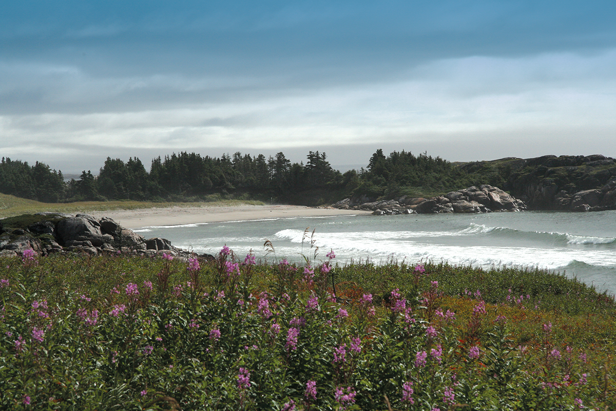
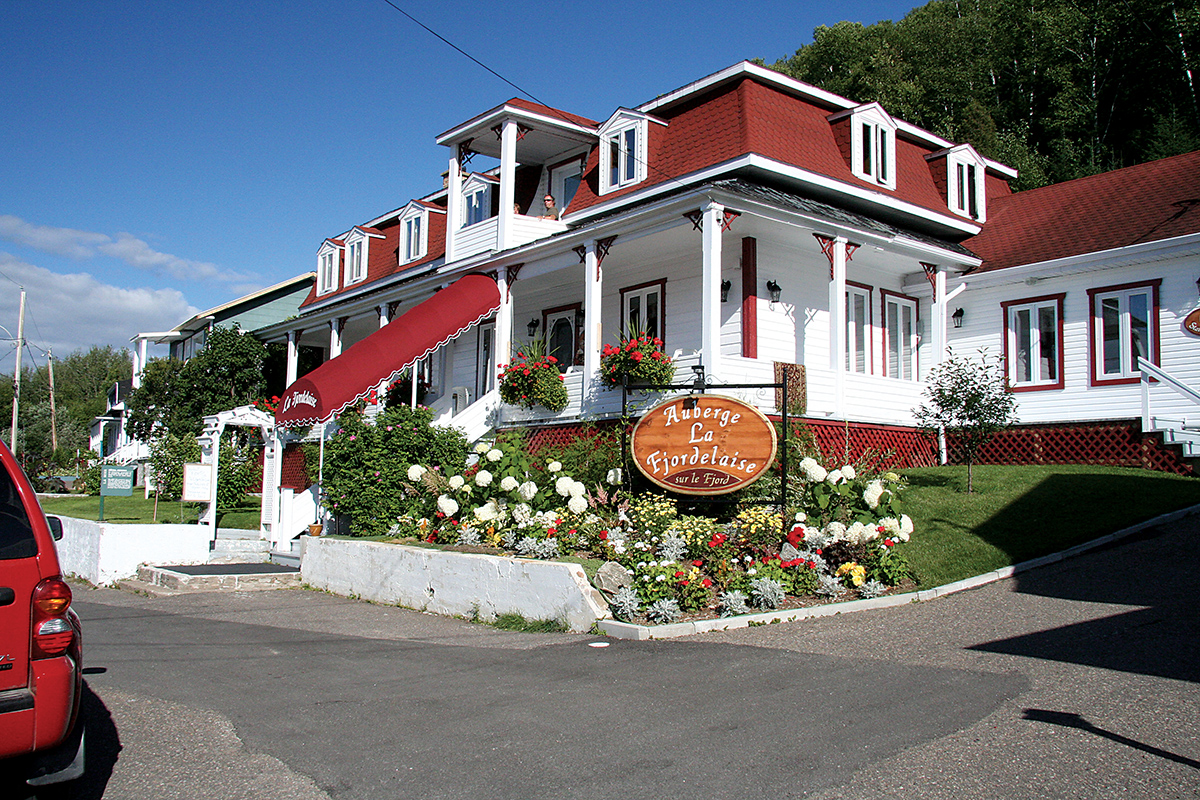
Que-138 continues to pavement end at Natashquan. A few miles of gravel road continue. Someday this route may join with Blanc Sablon in Labrador and the ferry to Newfoundland. The terrain is flatter with many wet boggy areas resembling northern tundra, and the wild flowers that grow along the road can be spectacular. If you want to drive to Natashquan, one of the furthest accessible communities on the Gulf of St. Lawrence, it might be wise to leave the RV at the campground in Sept Iles and drive a smaller vehicle because the highway is frequently twitchy and bumpy. Natashquan is the perfect picture of a fishing village with lots of gear lying round about. The Hotel Auberge la Cache is a very comfortable place to stay with good food.
Sylvia and I found the north shore scenery terrific and will return, perhaps in autumn to see the foliage colours when the far vistas from the higher hills should be spectacular. We found so many things to see that we didn’t know about, and the people were very friendly and went out of their way to show us around. If you haven’t explored the north shore now is the time to plan for it.
James Stoness is also author of ‘Touring North America’, a series of travel guides on CD to help you plan your trips across North America. Visit his website to read his novels and travel guides – https://stonessrvtravel.com/


