


By: Ben & Cheryl Coles – a.k.a. “Camping with the Coles”
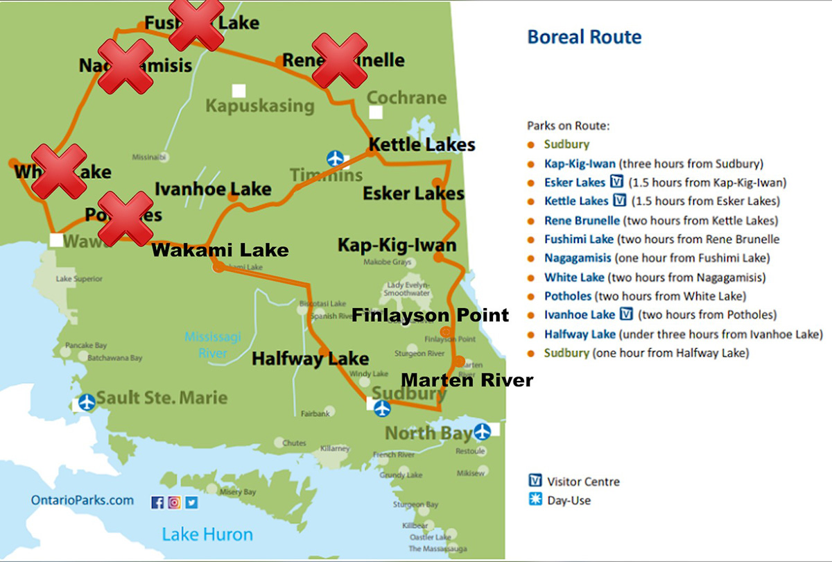
Intro and Description of the Boreal Forest
In late summer of 2025 Cheryl and I embarked on a 7 park camping trip in Northern Ontario. We followed the Boreal Route. This route is laid out by Ontario Parks and it starts in Sudbury. They designed it to help people discover Canada’s Boreal Forest. It’s a unique ecosystem unlike anything you’ll find in southern Ontario. The Boreal Forest is the largest forest region in the world. It spans 8 countries including Canada, the USA, China, Finland, Japan, Norway, Russia and Sweden. It’s also the largest forest region in Canada and the largest forest region in Ontario, covering 50% of Ontario’s land mass. The majority of organized camping in Ontario is done in southern Ontario and that’s in the Great Lakes – St. Lawrence Forest and the Deciduous Forest and that’s the majority of the camping we do. On this trip we wanted to expand our horizons and check out the Boreal Forest.
The Boreal Forest is predominantly made up of coniferous trees such as black and white spruce, jack pine, balsam, fir, tamarack and eastern white cedar. It has some deciduous trees such as poplar and white birch but coniferous trees dominate. This area of Ontario also has soil that is quite often sandy, and there are a lot of small kettle lakes made from melted blocks of glacial ice.
Planning
When planning a trip like this it takes some dedication and planning. In our case we weren’t only planning for us, we were having two other couples join us and that adds a little more stress to the reservation process. We wanted to book each park at the earliest possible time because we needed dates set for 3 campsites at each park to smoothly do our route. We decided that 3 nights at each park gives us a good chance to explore each park and see what they’re all about. The entire Boreal Route is 10 parks over 1700 km. We also have to add 500 km to get from our home to the start of the route and 500 km to get back home. So that means a total of 2700km. For us, that would mean at least 30 days and driving 2700 kms. That was a little too much for us so we made a plan for a mini-boreal route. After leaving Kettle Lakes, instead of continuing north to Rene Brunell, we went east to Ivanhoe Lake. That cut off the loop consisting of Rene Brunelle, Fushimi, Nagagamisis, White Lake and Potholes. We would do the southern loop. We also added a couple of parks at the beginning of the route that we’ve wanted to go to for a while that aren’t technically in the Boreal Forest but they are along the route. That was Martin River and Finlayson Point. Also, between Ivanhoe and Halfway Lake we did Wakami. We plotted it all out on Google Maps so that each park was around 2 hours from the next park. So that meant a total of 8 parks to camp at. After some research and discussion amongst our group we decided to just make Kap-Kig-Iwan a day trip instead of camping at it and that meant our trip was 7 parks to camp at over 21 days. That seemed manageable to us.
Now we had our plan set and it was time to make the reservations. We needed to book each park exactly 5 months before the arrival date at exactly 7 am. We all know the Campsite Lottery. The countdown to 7 am, hit the reserve button and hold your breath. Well, we had to do that 7 times and each time with the other couples on a group text chain finding out what everybody got. Each couple had a campsite they were going to try for and a backup site in case they didn’t get the first one. We wanted to make sure we weren’t competing with each other for the same sites. Each time it was a scramble of text messages and reservation attempts to ensure everyone got in. Sometimes we were lucky to get sites close together, other times we were pretty spaced apart. For those of you that are used to this chaos of making reservations you might think this is almost impossible to do. However, the further north you go, the easier it is to get a campsite. Yes, these parks are smaller with fewer sites but most of the population lives in southern Ontario and they don’t want to travel that far north, so it’s easier to get in those parks. This would be way more difficult to do with parks in southern Ontario. After repeating this crazy process 7 times we had our parks booked. Now we just had to wait 5 months to get going camping.
The Trip
Martin River Provincial Park
On July 24th we headed out. We arrived at Martin River Provincial Park at about 7:45 pm. This park has 197 campsites consisting of 104 electric and 93 non-electric sites. We had a really large site that went back pretty far and we were close enough to the water that we could just carry our kayaks over. We were also very close to one of the 3 beaches.
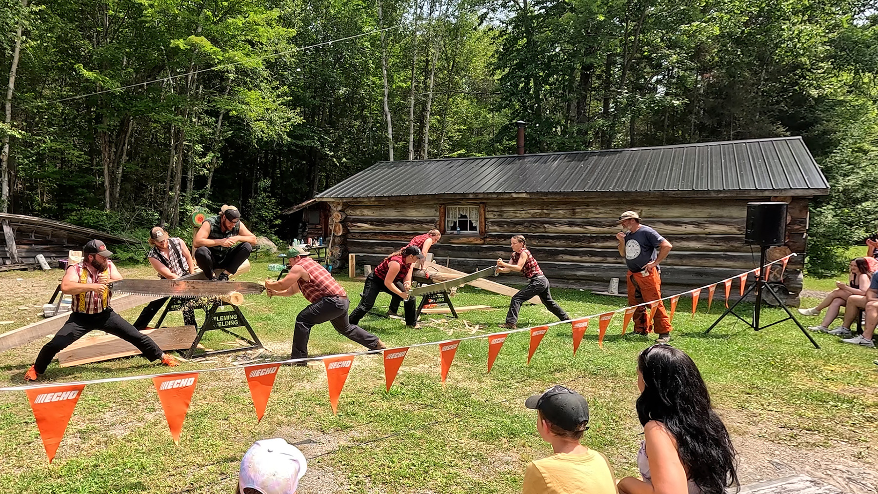
We were lucky enough to be there for the Fleming Loggersports. These student from Fleming College compete all over in loggersports. They come to Martin River Provincial Park on the last Saturday of July each year to show off they’re lumberjack skills. They have chainsaw competitions, chainsaw carving, axe competitions, axe throwing and various relays. Cheryl and I competed in a log toss competition and we also got to see a real blacksmith at work. It was a great time for everyone.
If you want to go to this park and you’re trying to decide between bringing bikes or watercraft, we’d suggest watercraft like canoes, kayaks, stand up paddle boards or even motorboats. This park is great for that. There are a lot of waterfront sites that you can launch directly from your site. The cycling in the park is pretty rough because it’s really hilly.
We rated this park an 8 out of 10 and our dog Jax rated it a 6 out of 10.
Finlayson Point Provincial Park
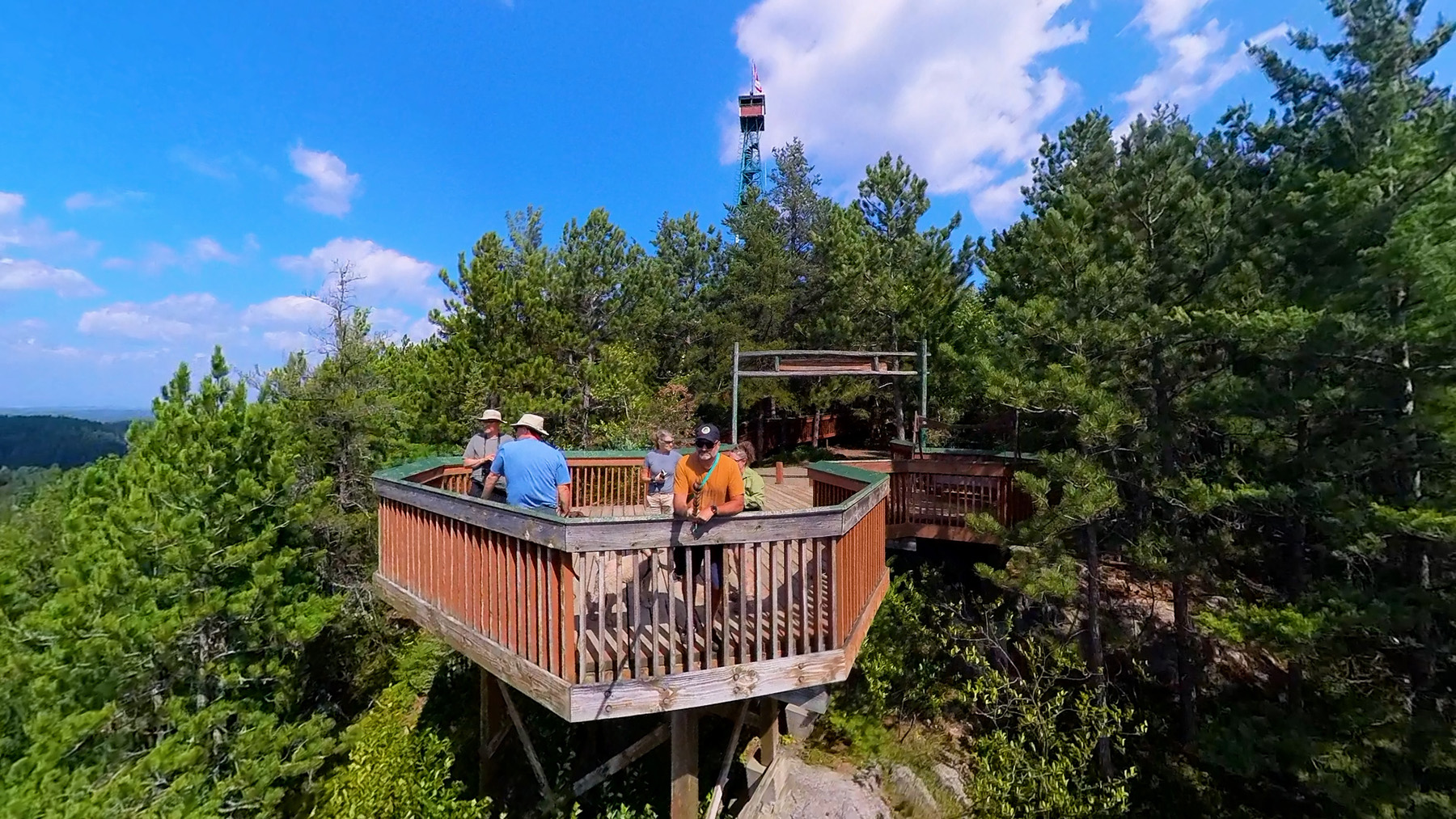
We left Martin River on July 27 and did the half hour drive to Finlayson Point, arriving around 1pm. This park has 108 campsites consisting of 41 electric and 67 non-electric sites. We were immediately impressed with the newer gate house, that I believe is also the staff house and a very nice public washroom. We got a small pull-through site. Similar to Martin River, this is a very hilly park, which makes it difficult for cycling. It has a great boat launch into Lake Temagami for all kinds of watercraft. You can also put in canoes and kayaks at a couple other spots, one of which was very close to our site. There are no hiking trails in the park but right across the street is Caribou Mountain/White Bear Forest Conservation Reserve with 17km of free hiking trails. It also has the Temagami Fire Tower. If you going this way, you have to check out the fire tower. For a small voluntary donation, you can check out the stunning view from the base of the fire tower and if you’re feeling brave you can climb to the top of the fire tower. Cheryl is deathly afraid of heights, but she summoned up the courage to climb to the top. She was scared and white knuckling it the whole way up and down but she did and she was glad she did.
The town of Temagami is just 1 km away and you can get supplies there. We had lunch at the Outfitter Bar & Smokehouse. It was very nice eating on the patio, overlooking the marina and a float plane. We saw a family paddle over from their campsite on stand-up paddleboards.
We enjoyed paddling on Lake Temagami and checking out campsites and cottages. There are a lot of motor boats on the lake and the lake is used for float planes landing and taking off. The lake is supposed to be really good for fishing but we didn’t check that out for ourselves.
We rated this park 7 out of 10 and Jax rated it 5 out of 10.
Esker Lakes Provincial Park plus Kap-Kig-Iwan Provincial Park
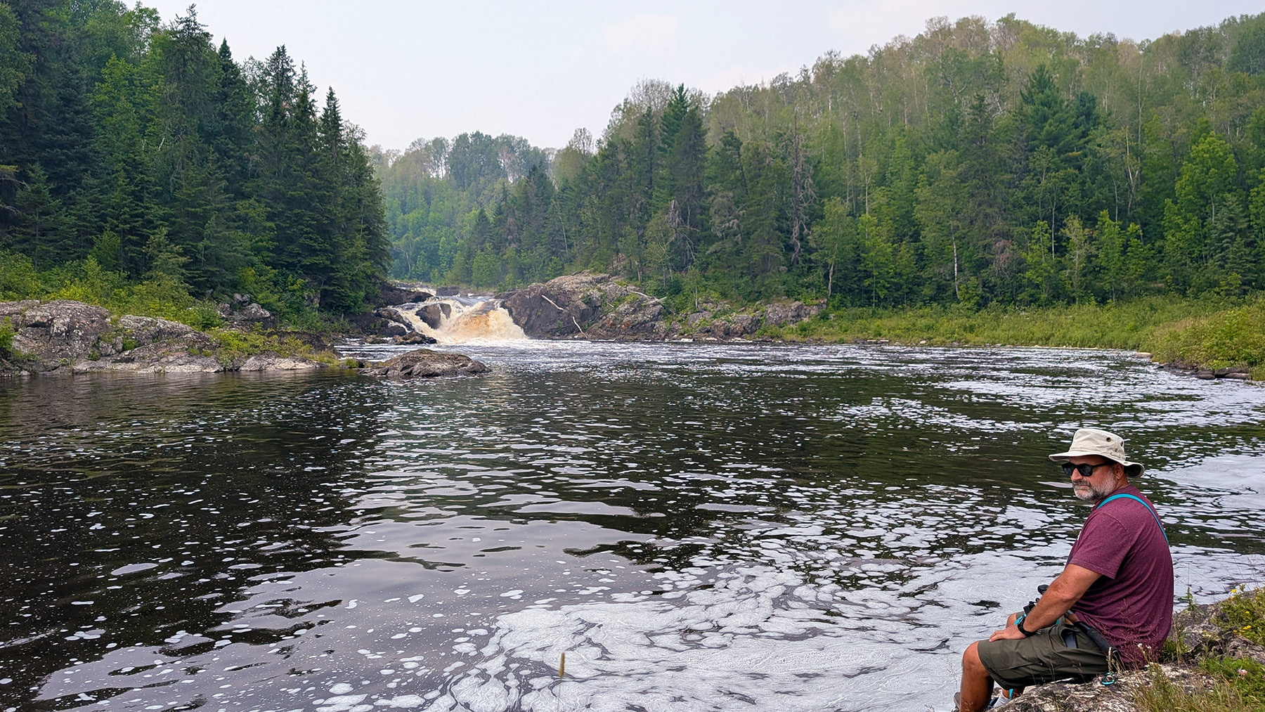
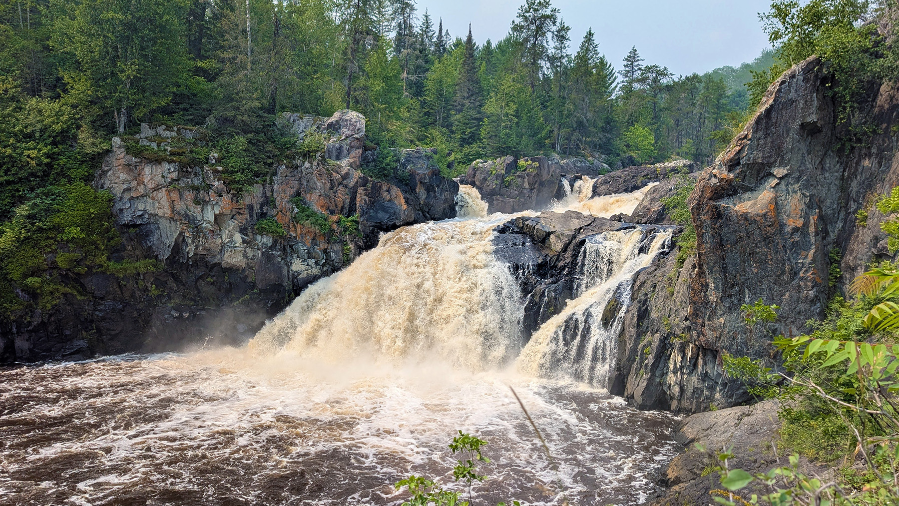
We left Finlayson Point on July 30th to head to Esker Lakes Provincial Park. This is about a 2 hour drive. About halfway between the two parks is Kap-Kig-Iwan Provincial Park. This park only has 43 campsites consisting of 32 electric and 11 non-electric sites. We decided to stop in there along the way for a hike. The hiking there was fantastic. We finally transitioned to the Boreal Forest. The High Falls Trail is a 500-meter linear trail along the Englehart River that takes you to the base of the majestic High Falls. The Hell’s Gate Trail is a 2.3 km loop trail that follows the river through dramatic waterfalls, rapids and deep ravines.
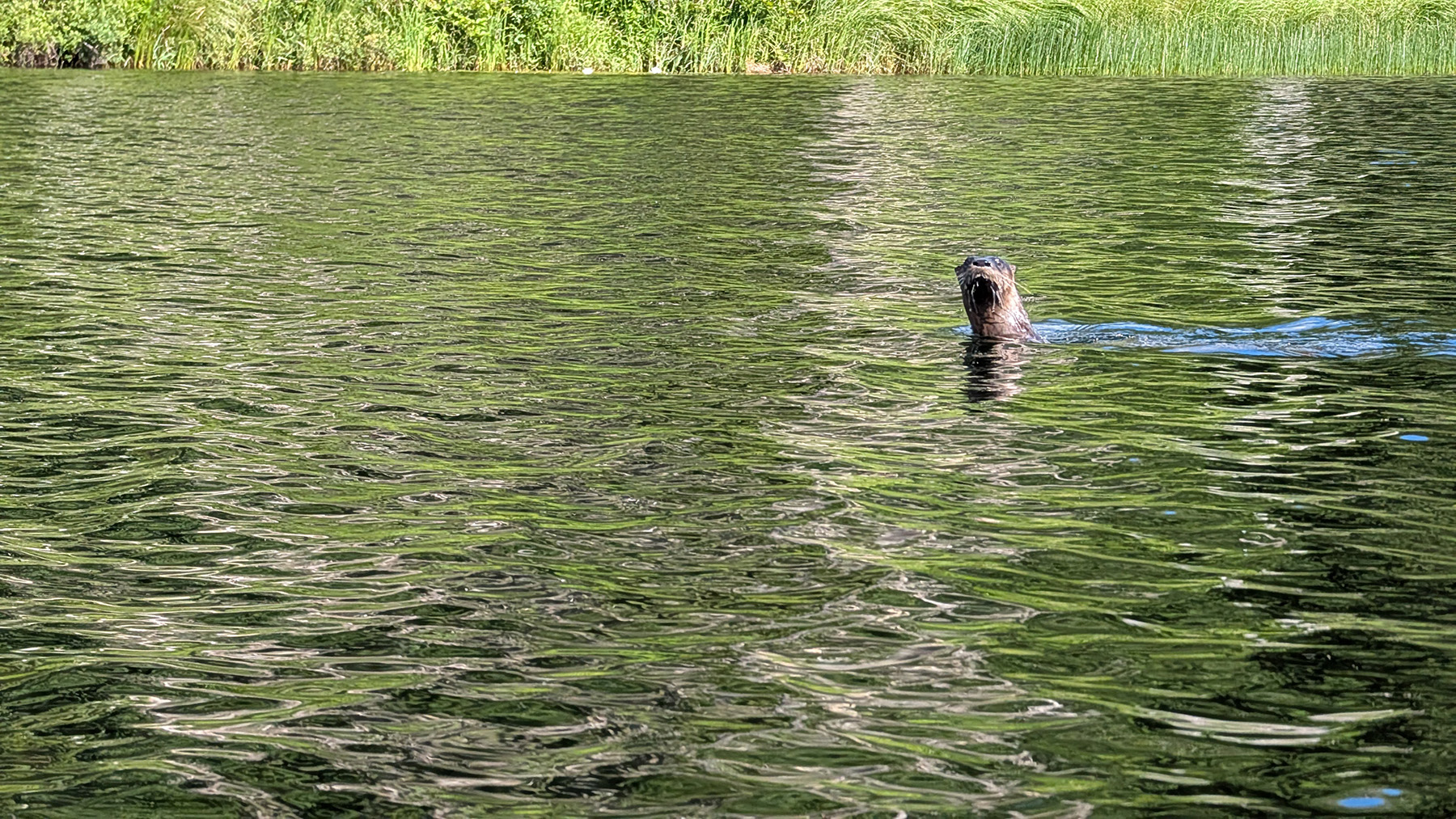
We continued on our way to Esker Lakes. This park has 103 campsites consisting of 64 electric and 39 non-electric sites. The 16 km drive on Hwy 672 to the park entrance has no shoulders so we really hoped we wouldn’t break down or get a flat in that area. We also had to drive 30 km on that road when leaving the park to head to Kettle Lakes Provincial Park. There area quite a few seasonal sites at this park and our campsite was between two of them. It made for a very quiet time at the campsite as the seasonal campers weren’t there. The park is littered with kettle lakes with the main campground being along Panagapka Lake and Lallan Lake. Both are small lakes ideal for paddling on. Motorboats are not permitted. When out paddling we were treated to the site of an otter checking us out and numerous loons. The roads were nice for riding our bikes on and exploring the entire campground.
We rated this park a 7 and a half out of 10 and Jax rated it a 6 out of 10.
Kettle Lakes Provincial Park
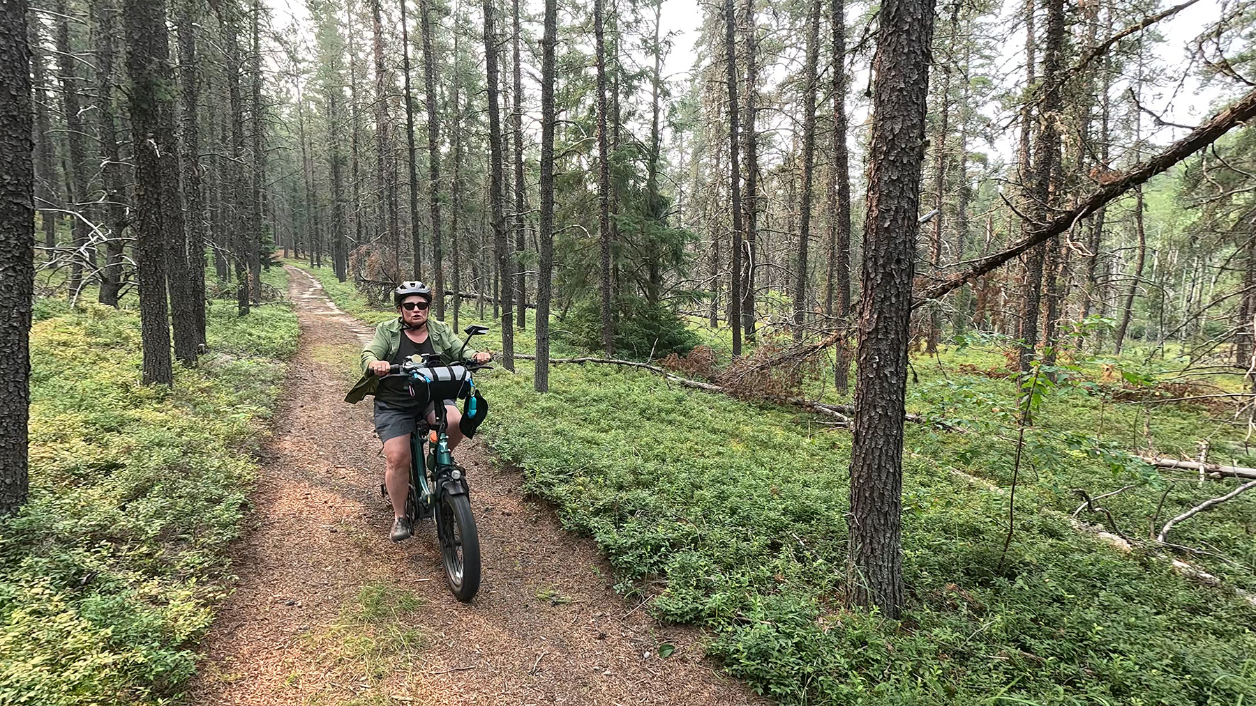
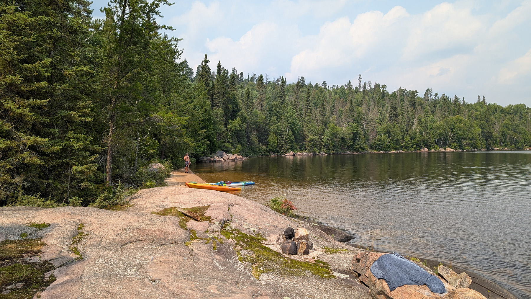
Then it was off for a two hour drive to Kettle Lakes Provincial Park on Saturday August 2nd for the Civic Holiday weekend. The first part of the drive was on Hwy 672 with no shoulders and the rest of the way was on Hwy 101. It has shoulders but they are very narrow. This park has 134 campsites consisting of 92 electric and 42 non-electric sites. The park also has a bunch of kettle lakes in it. We like how spread out it was with 3 beaches on 3 different lakes and a road that takes you to many of the lakes. We especially liked that it had about 15 kilometers of bike trails consisting of 3 loops rated as easy, moderate and difficult. We easily did all 3 bike trails on our folding e-bikes. We had a nice easy paddle on Island Lake. If I had to choose between bringing bikes or kayaks for this park, I’d bring bikes. It’s a spread-out park, nice for cycling the roads and trails. The lakes are all very small and not really close enough for easy portaging between them so the paddling is limited.
We rated this park an 8 out of 10 and Jax rated it a 5 out of 10.
Ivanhoe Lake Provincial Park
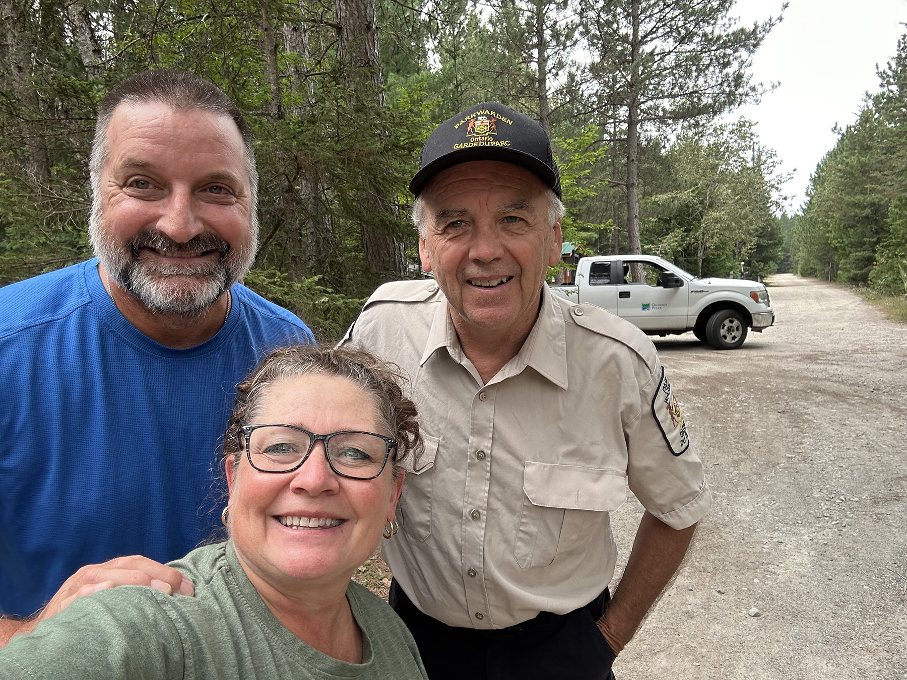
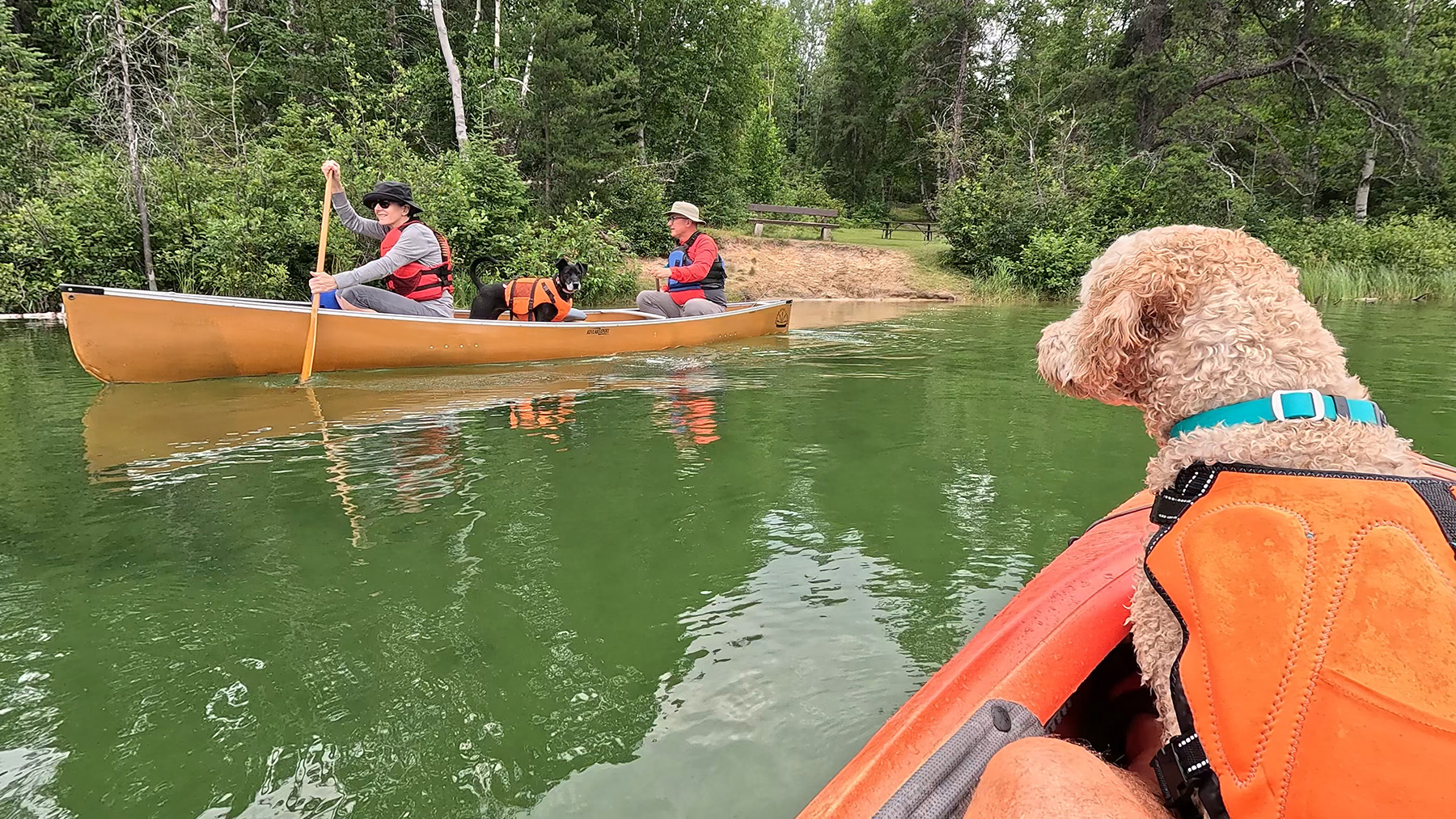
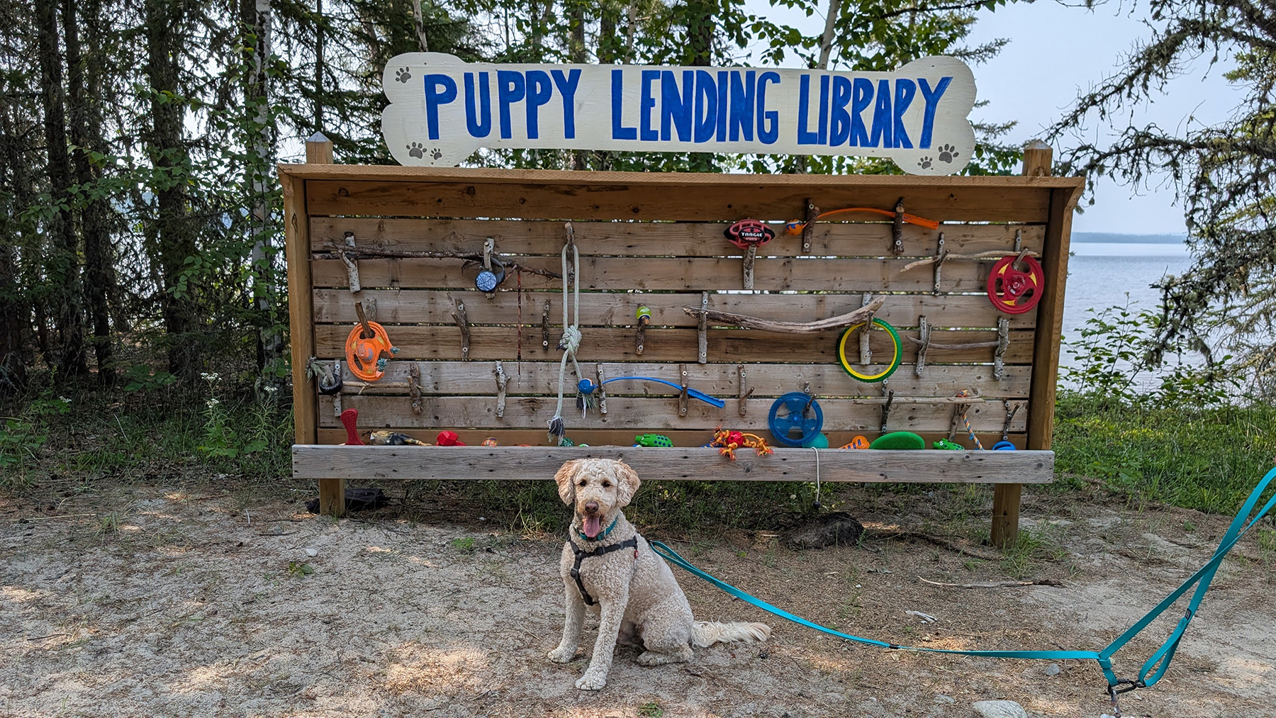
On Tuesday August 5th we headed off to Ivanhoe Lake Provincial Park. It was about a 2 hour and 10 minute drive on Hwy 101 almost the whole way. We made a couple of stops in Timmins to replenish our supplies and get some gas. Ivanhoe has 93 campsites consisting of 52 electric and 41 non-electric sites. Included in that are numerous seasonal sites. What struck us both immediately in the park was the signs. All the signs were nicely framed with stained wood. As our time there went on, we noticed more signs, the comfort stations, the water sheds and outhouses all refurbished with stained wood. It made for a great first impression. The staff here care about their park. We met the warden, Daryl, who we found out was a big part of all these improvements. This park had a toy lending library on the main beach. Kids could grab toys to play with while there and return them when done. Then, what we really loved was the dog beach and Puppy Lending Library. It was a nice beach with picnic tables and water that stayed shallow a long way out. Dogs can choose a toy to play with at the Puppy Lending Library and play with it until they’re ready to play with another toy. Our dog Jax and our friend’s dog Cooper, spent a lot of time at this beach and it kept them good and tired. There is lots of water access to Ivanhoe lake which permits all manner of watercraft and there is Saw Lake for non-motorized fun. There is good fishing in both lakes.
We rated this park an 8 out of 10 and so did Jax.
Wakami Lake Provincial Park
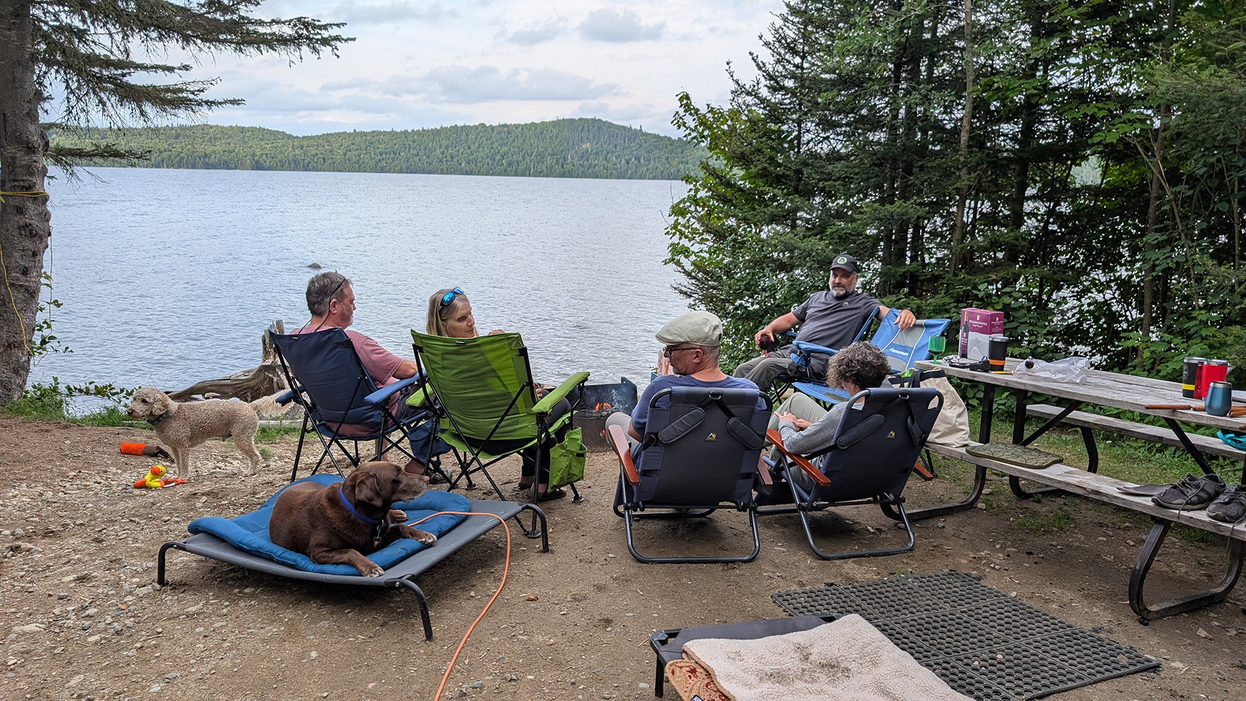
We left Ivanhoe for Wakami Lake Provincial Park on Friday August 8th. It was an hour and 45 minute drive on roads with very narrow shoulders the whole way. The road into Wakami is a 6 km gravel road that is surprisingly in very good shape. The park has 59 campsites. There is no electricity running to the park. All electrical needs are taken care of by a diesel generator. It’s used to power the staff house, office, water pump, laundry and maintenance building. There are no comfort stations, no showers and no electricity at any campsites. If people are coming to Wakami it’s for the fishing. Wakami Lake is fairly large and allows motorboats. Because of it’s size it can get rough. There are a lot of waterfront sites where people often anchor their boats at their sites. Our friends, Sue & John, had a waterfront site with a nice view. We spent a lot of time there, hanging out and having fun in the water. Cycling is a good way to explore this park. The roads are in pretty good shape and the campground is spread out along the lake making it ideal for cycling.
We rated this park a 7 out of 10 and Jax rated it a 5 out of 10.
Halfway Lake Provincial Park
On Monday August 11th our time ended at Wakami. When we announced this trip back in April, many people reached out and warned us to not take the Sultan Industrial Road, which is the shortest way to get from Wakami to Halfway Lake Provincial Park. It’s shown as a 2 hour and 20 minute drive. When I plotted out the route back in January, Google Maps showed to take the Sultan Industrial Road. We spoke to an employee of a gas station near Wakami and to staff and visitors of the park and most suggested we not take it, especially with a new truck and towing a travel trailer. We would have to travel about 90 kilometers on a gravel logging road with logging trucks. Stone chips on truck and trailer and windshield are common and there are often washboard type sections of road wreaking havoc inside the trailer. We decided to take another route. That’s when we found out any other route would more than double the length of the trip. We decided to go south down Hwy 129 to Hwy 17, over to Sudbury than north on Hwy 144 to Halfway Lake. A 5.5 hour trip. I will say that Hwy 129 was a very scenic drive as it followed along side the Mississaugi River for a lot of it. But, had I initially researched this route a little more at the beginning, instead of waiting until we were on the trip, we may have chosen not to go to Wakami as it is out of the way.
We got to Halfway Lake and were immediately impressed by the fill/dump station and garbage area. It was new looking and spacious. This park has 219 campsites consisting of 122 electric and 97 non-electric sites. We were very impressed with the campsites. Most sites seemed similar in size and shape. They were big, flat and open, yet surrounded by trees offering great privacy. You may need some extra extension cord here as we needed 100 feet to reach the electrical pedestal. The beach extended along a lot of the shore of Halfway Lake, with the dogs being permitted on the end closest to Hawksnest Campground. Dogs are permitted off leash in the water but need to be leashed on land. It was sandy and shallow for a long way out. Halfway lake is a fairly large lake that can get choppy. Motorboats are permitted. We had an ideal day where it was calm and we paddled along the western shore of the lake and found a very nice private little beach. We were able to get out, stretch our legs and take a little break there. If you’re more adventurous you could travel to the south end of the lake and portage to the next lake where there are some backcountry sites. There are a few nice hiking trails of varying lengths and difficulties with some nice lookout points. The only place to cycle is on the campground roads which are pretty flat and easy to travel on. I don’t know if we just happened to be there at a bad time but we found that the infrastructure of the park was generally lacking. There was always something out of commission at every comfort station with one comfort station completely closed for most of one day. It was either showers, toilets, urinals or laundry, there was always something. And the outhouses didn’t fair much better as some were locked, some pits were full and some were in disrepair. Overall, we liked the park and would recommend it but they need to pay some attention to the infrastructure.
We rated this park a 7 and a half out of 10 and Jax rated it a 7 out of 10.
Coles Notes
Exploring Ontario’s Boreal Route is a unique experience. The parks in this part of Ontario area generally less busy and easier to make a reservation than southern Ontario parks. There’s room for RV’s of all sizes at all the parks we went to. If you’re interested in exploring the Boreal Route you can check out our YouTube video:
You can also check out the Ontario Parks Blog: https://blog.ontarioparks.ca/boreal-driving-route/
For a more detailed review of each park mentioned above you can check out these videos:
- Marten River Provincial Park: https://youtu.be/qWHE-_1AuAs
- Finlayson Point Provincial Park: https://youtu.be/0rIBibXuBLQ
- Kap-Kig-Iwan Provincial Park and Esker Lakes Provincial Park: https://youtu.be/YyO-DMrvrp8
- Kettle Lakes Provincial Park: https://youtu.be/3zeP9p5rU5E
- Ivanhoe Lake Provincial Park: https://youtu.be/Zz0LhgmJ_8E
- Wakami Lake Provincial Park: https://youtu.be/CRhWRSZEH6M
- Halfway Lake Provincial Park: https://youtu.be/7FTBgdJJxtQ


